• Afrika
  • Amerika
  • Asie
  • Evropa
  • Karibik
  • Oceánie
  • Rady a inspirace
  • Průvodce
  • Itineráře
  • Přednášky
  • Kontakt
  • Čeština
  • English
Live and Tavel
Author

Petr Hingar

Petr Hingar

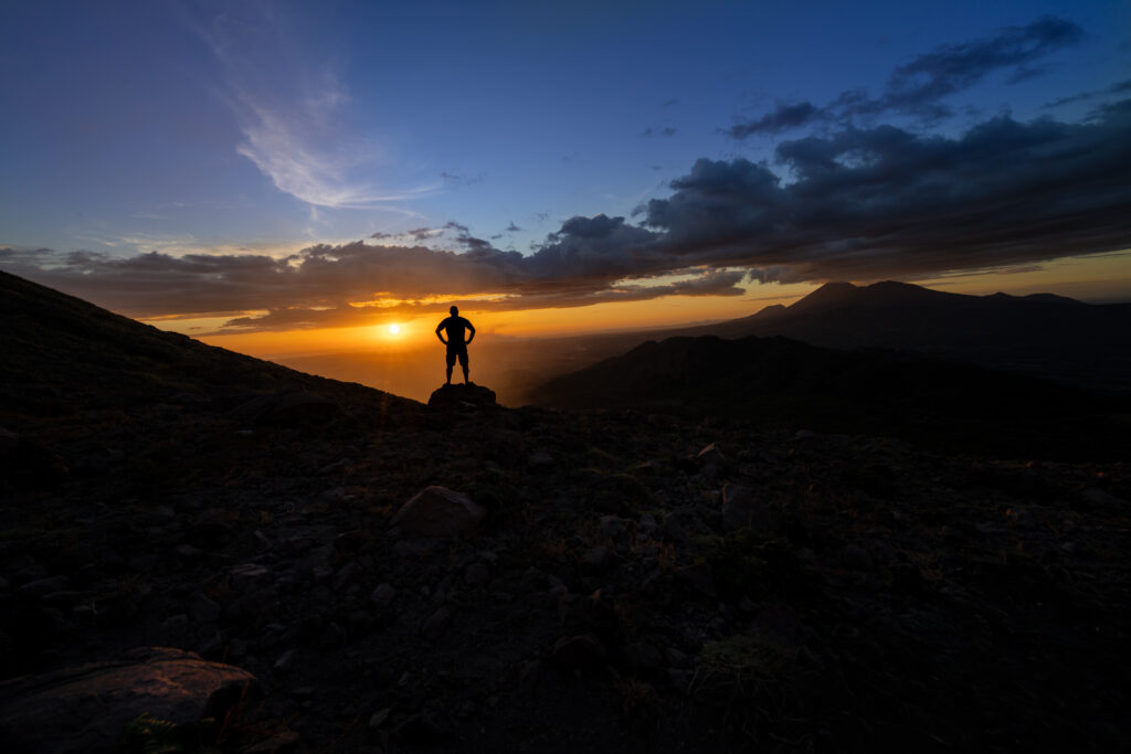
Nicaragua, Volcano San Cristóbal
Nicaragua

Nicaragua: 11 places among volcanoes, rainforest and mystery

by Petr Hingar September 20, 2026
written by Petr Hingar

Nicaragua has many more faces than it seems at first glance. The colorful streets of colonial cities alternate with the slopes of volcanoes, coffee plantations disappear into the mountain mist and rivers slowly wind their way deep into the jungle. On one side of the country, the Pacific roars, while inland, two volcanoes of Ometepe Island rise above the surface of a huge lake. And then there are places still shrouded in mystery, beyond which reason remains baffled and even modern science offers no clear answers. Places like Canta Gallo.

I've selected eleven places that together offer a cross-section of what I love about Nicaragua. You'll find familiar stops like Granada, León, and Ometepe, but also places that not many travelers go to anymore. From volcanic craters to the cloud forests of Peñas Blancas to the Río San Juan and the coast at Los Zorros. Each one shows a slightly different Nicaragua.

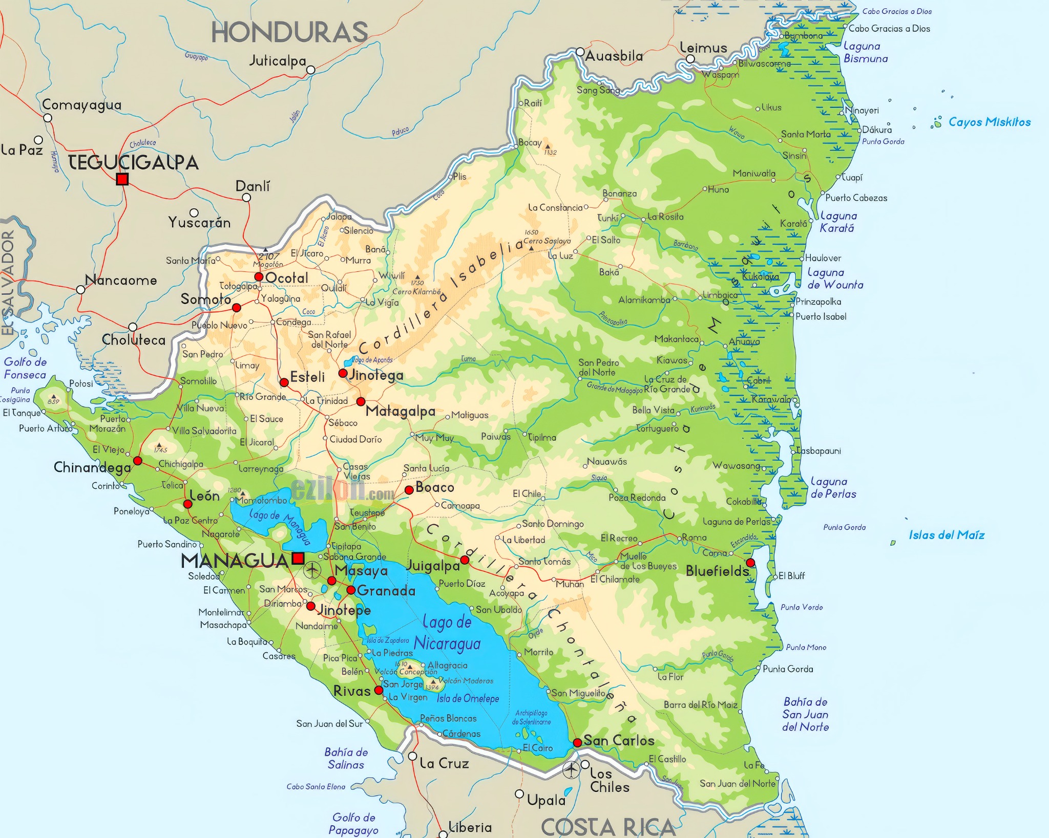
Mapa Nikaraguy s jedenácti místy k návštěvě1234567891011
Fotografie připravujeme

Přejít k textu a fotografiím ↓

1. Río San Juan a El Castillo 2. Canta Gallo 3. Telica 4. San Cristóbal 5. Matagalpa 6. Rezervace Peñas Blancas 7. Los Zorros 8. Ometepe 9. Granada 10. León 11. Masaya

Río San Juan a El Castillo

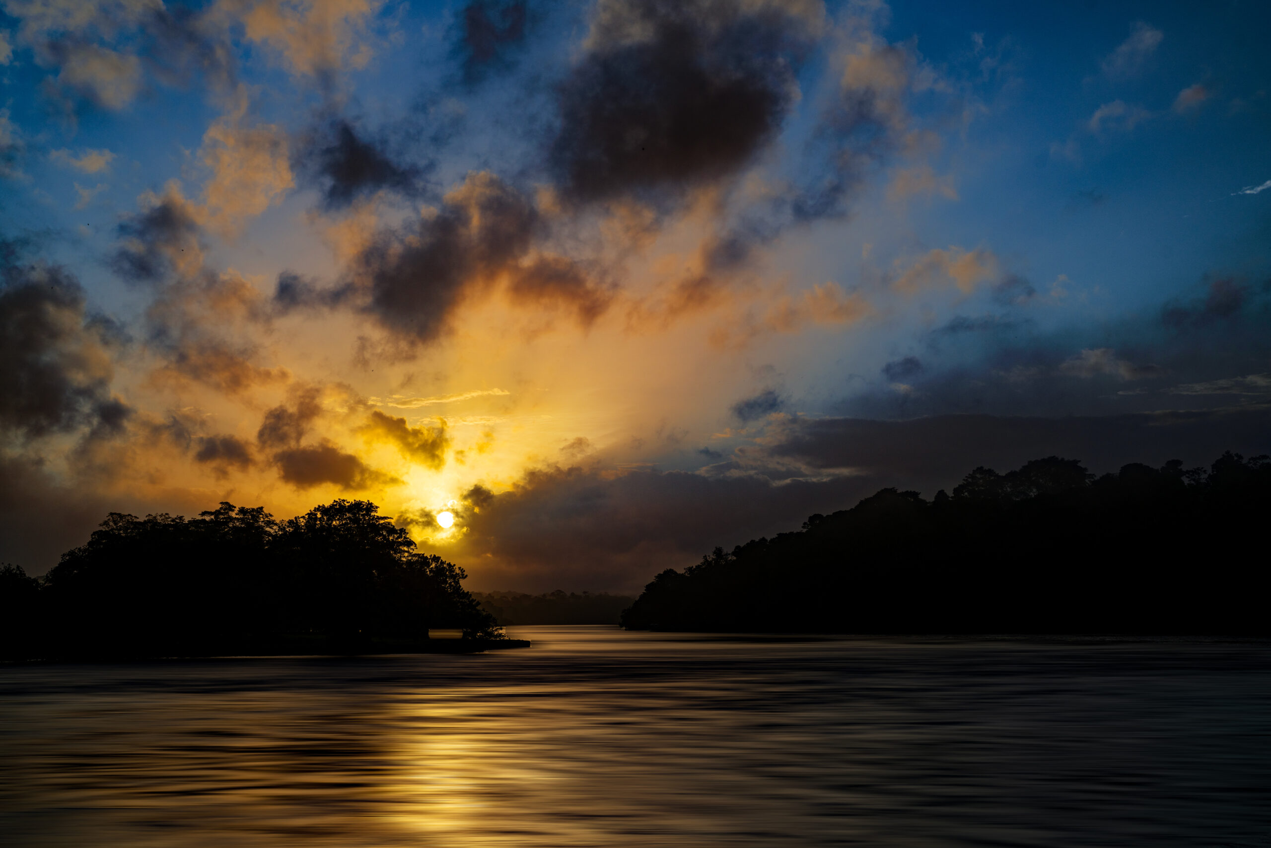
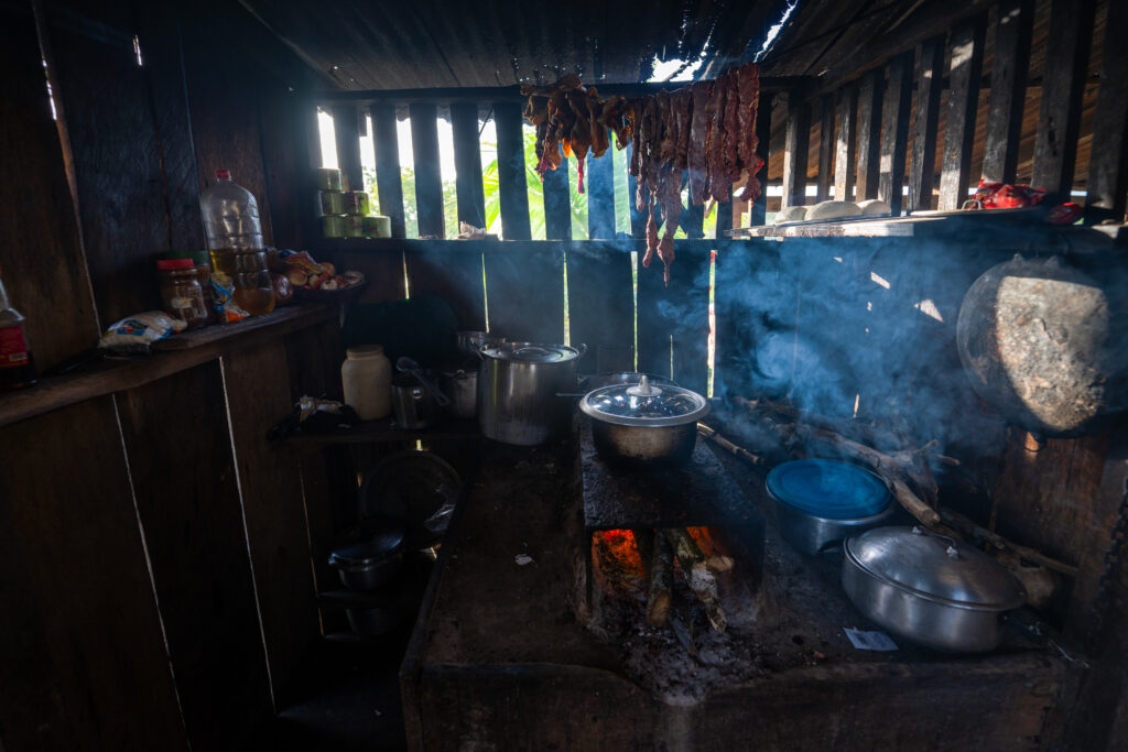
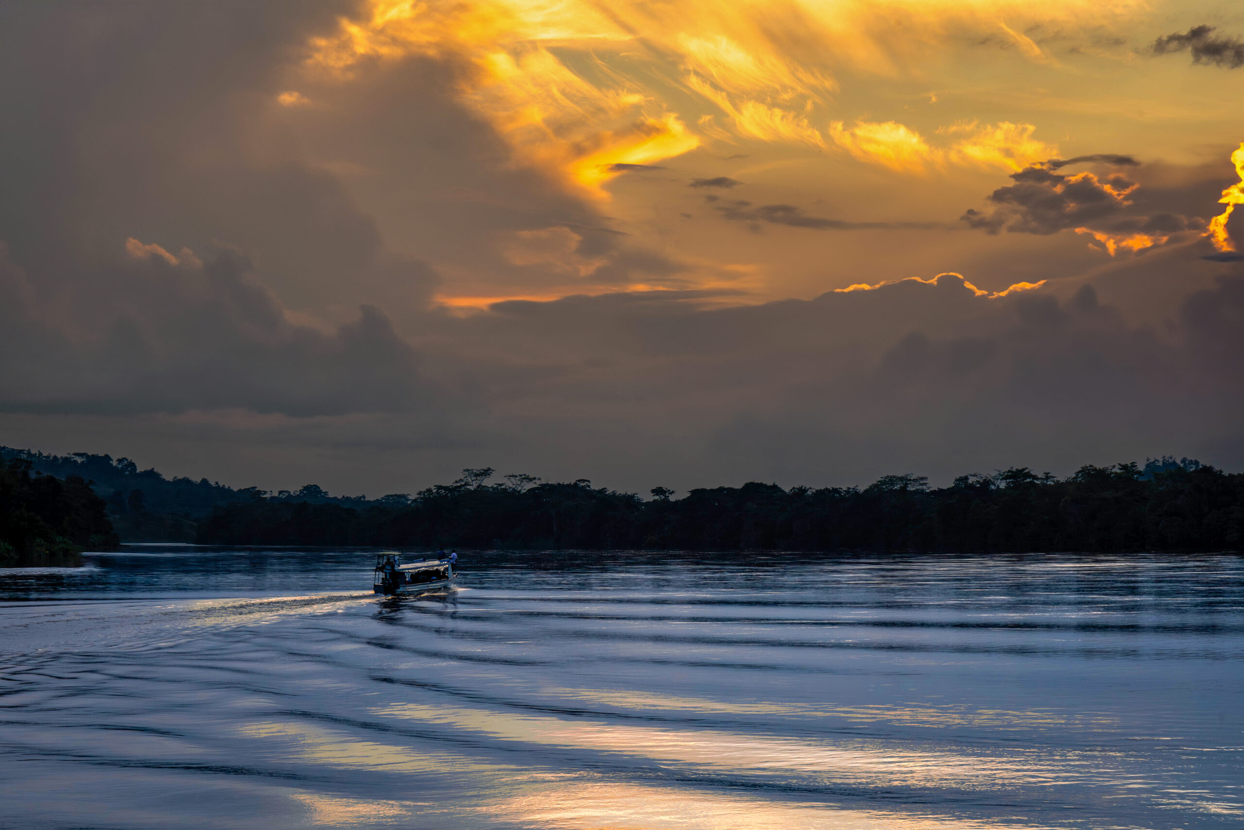
The Río San Juan has a special charm. It flows from Lake Nicaragua and gradually sinks deeper and deeper into the jungle along the border with Costa Rica. In a narrow boat, you are crowded with local Indians, goods for sale and sometimes even domestic animals. You pass small villages and lonely wooden houses for which the river is the only connection to the outside world.

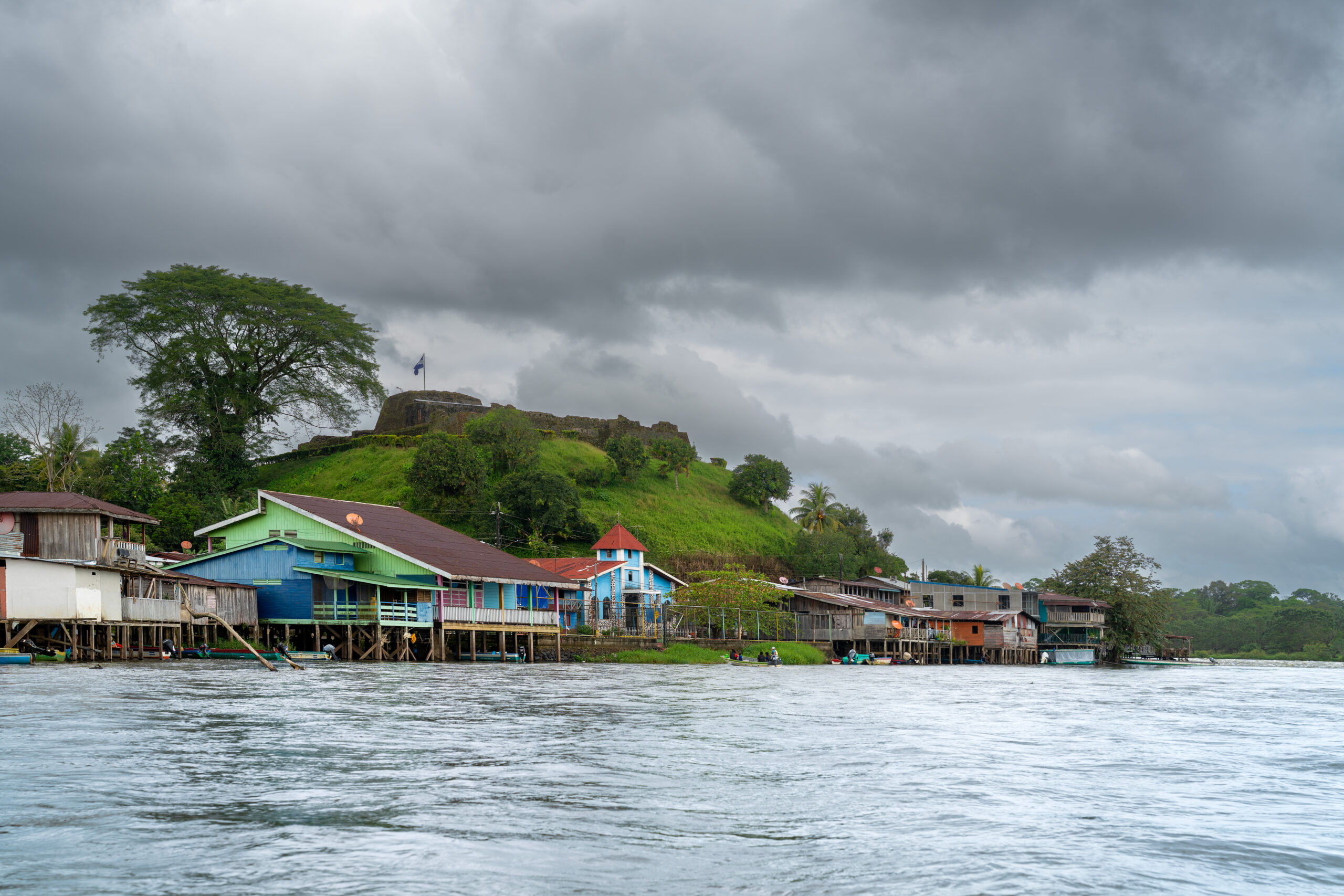
Before El Castillo, the calm sailing is replaced by the Raudal del Diablo rapids. Directly above them rises an old Spanish fort and below it a small town of colorful wooden houses without a single road. El Castillo is the last outcrop before the river disappears into the rainforest and continues to the Caribbean. The Río San Juan is also the only access road to this part of the Indio Maíz reserve, one of the largest rainforests in Central America.
Popis první fotografie Popis druhé fotografie Popis třetí fotografie

How to get there?

There are direct buses to San Carlos on the shores of Lake Nicaragua from the Mercado Mayoreo terminal in Managua, taking approximately seven to eight hours. From San Carlos, public boats continue along the Río San Juan to El Castillo and other settlements further downstream. The journey takes several hours, depending on the type of boat and the number of stops. El Castillo is not connected to the road network, so it is a good idea to check departure times directly at the port in San Carlos
↑ Back to map

Indio Maíz & Canta Gallo

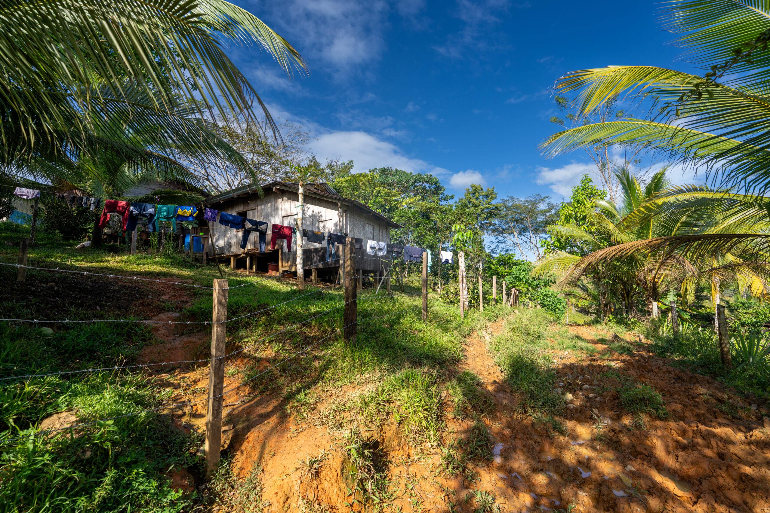
The Indio Maíz Reserve protects one of the largest and best-preserved lowland rainforests in Central America. One of the places you can enter it is the small community of Bartola on the river of the same name. The boat gradually slowed down, the surrounding vegetation thickened, and monkeys, toucans, and other forest dwellers sounded overhead. From there, we continued on foot along narrow paths into a green world that seemed to have no end.

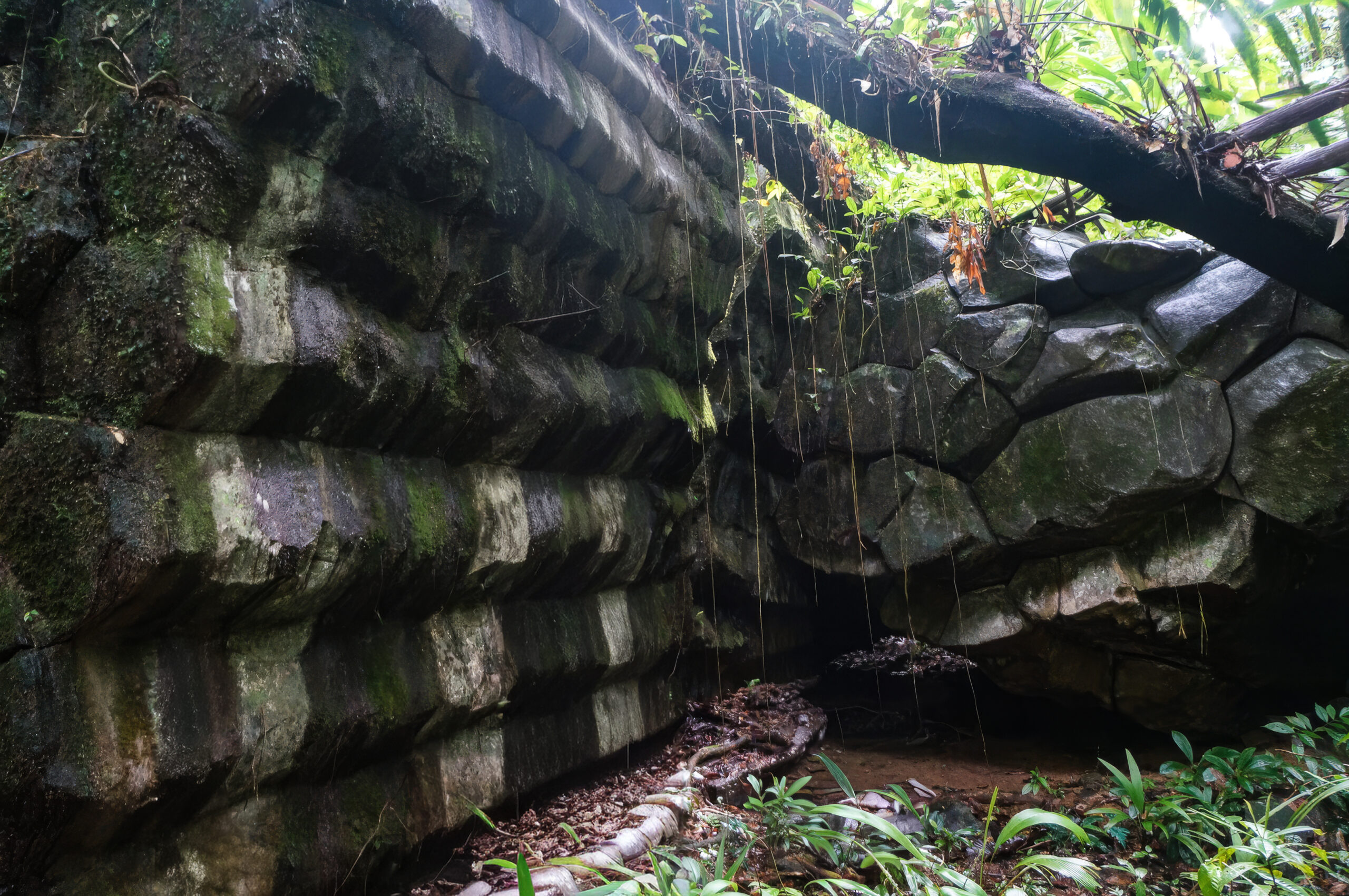
Even deeper into the jungle lies Canta Gallo, a small community of indigenous Rama people and one of the most mysterious places in Nicaragua. Hidden among the trees are massive stone structures resembling stepped pyramids. Who built them, when they were built, and what they were used for, no one knows for sure. I am not a spiritual person, but here I myself did not know what to think. I just stood in silence, looking around me, and soaking up the atmosphere of a place that has kept its secrets to itself for now.
Popis první fotografie Popis druhé fotografie Popis třetí fotografie

How to get there?

To reach the Indio Maíz reserve, you can continue from El Castillo with a guide by boat to the Bartola River. After Canta Gallo, you must sail to San Juan del Norte, hire a local guide and continue with him by boat and on foot deep into the jungle.
↑ Back to map

Volcano Telica

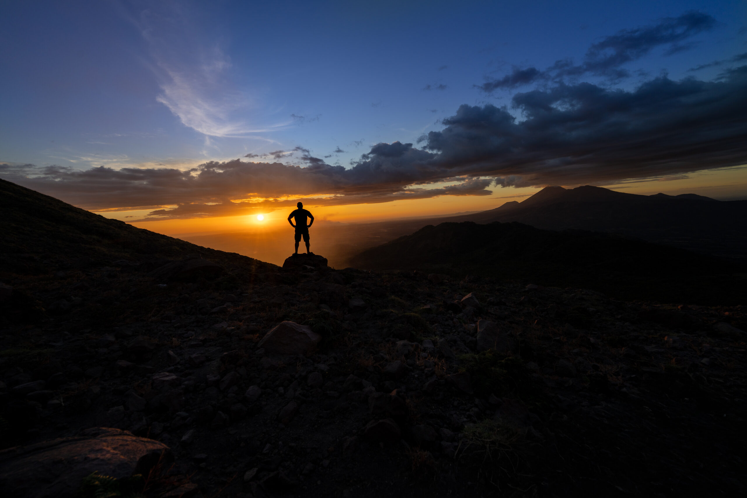
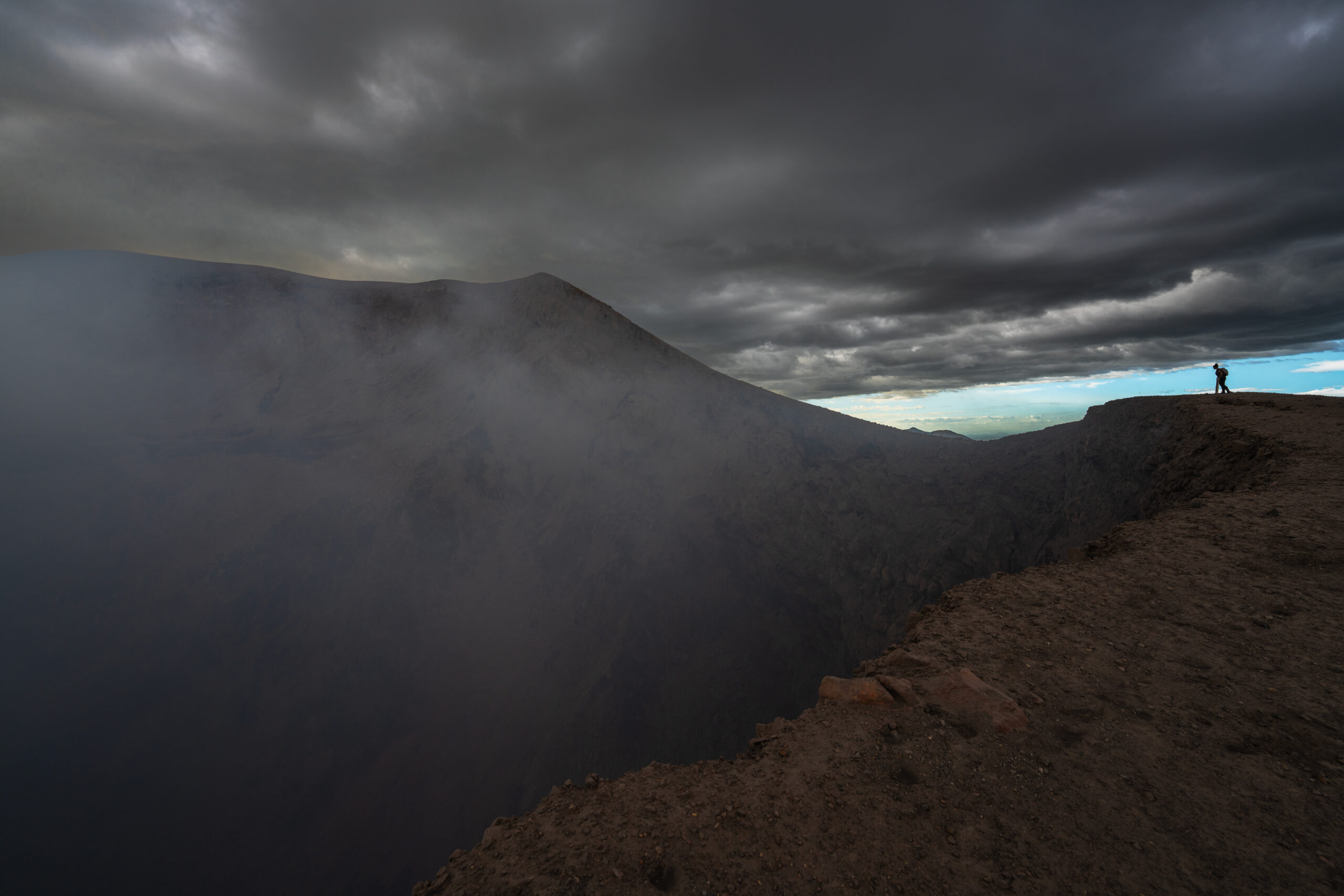
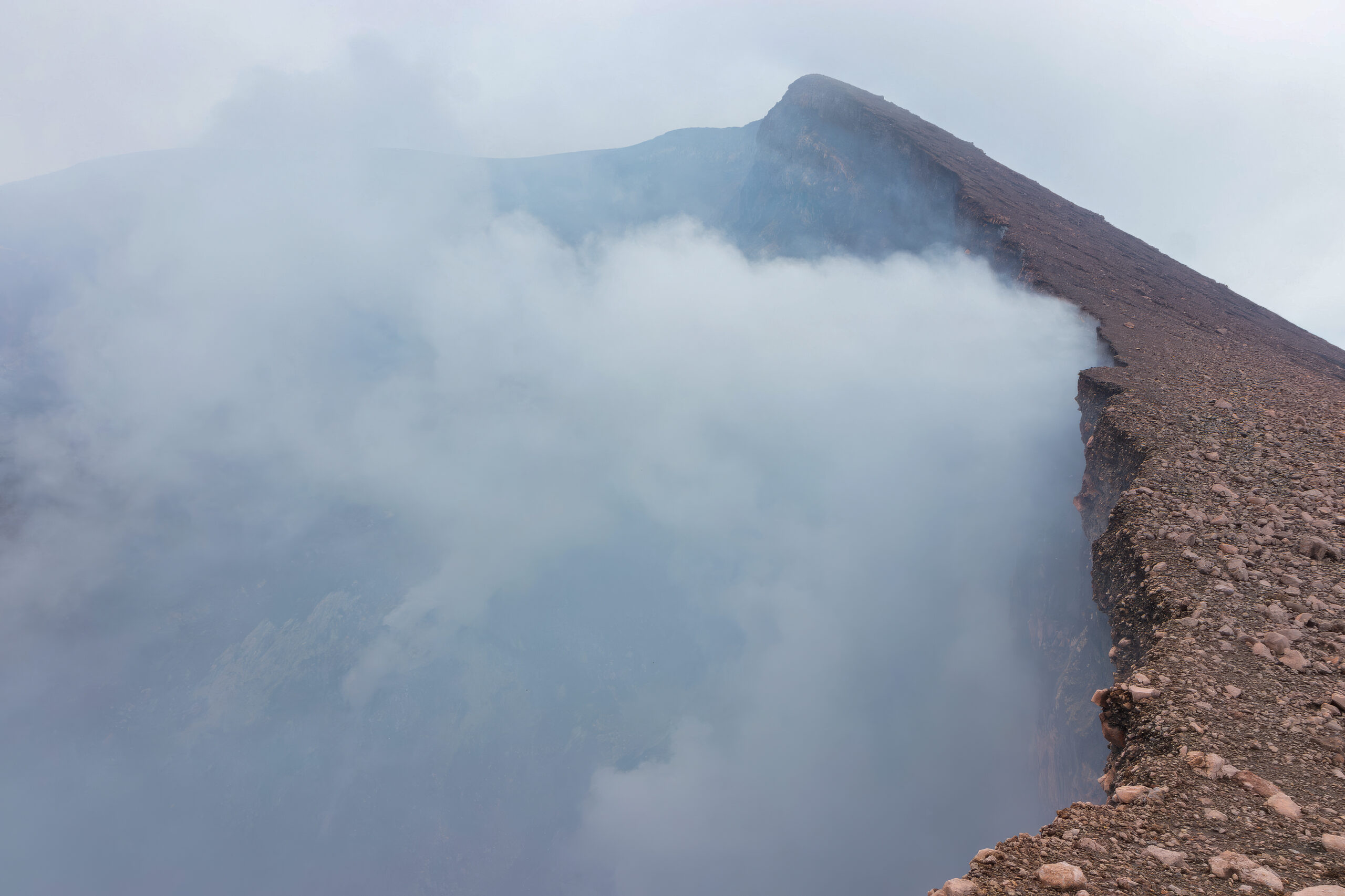
The climb to Telica Volcano is not difficult. The one-day trek leads through open countryside to a huge crater, from which sulfurous smoke rises and a dark rumbling echoes from the depths. You stand just a few meters from the edge, looking into the interior of one of Nicaragua's most active volcanoes.

The volcano is located on the territory of a local Indian community, whose members collect entrance fees at the top. And since there is a small shop in the middle of the desolate volcanic landscape, they also sell cold beer. Just sit on the slope, open a can of cold beer and wait for the setting sun to bathe the surrounding hills and volcanoes in orange light.
Popis první fotografie Popis druhé fotografie Popis třetí fotografie

How to get there?

You can go on a longer trek to Telica on your own, but it is easier and often more economical to go with one of the local agencies in León. They provide transport by off-road vehicle closer to the volcano, a guide, and return after sunset.
↑ Back to map

Volcano San Cristóbal

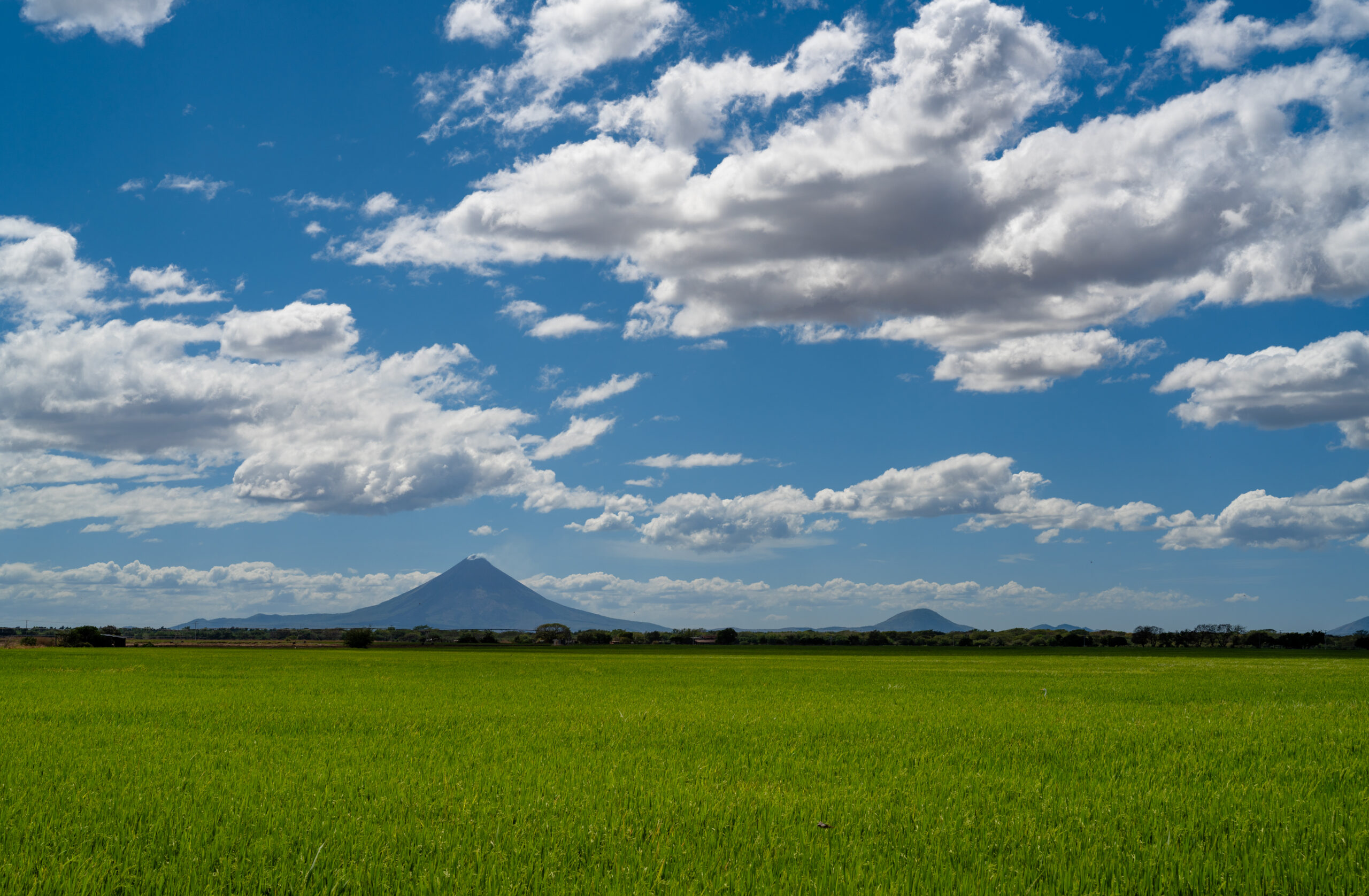
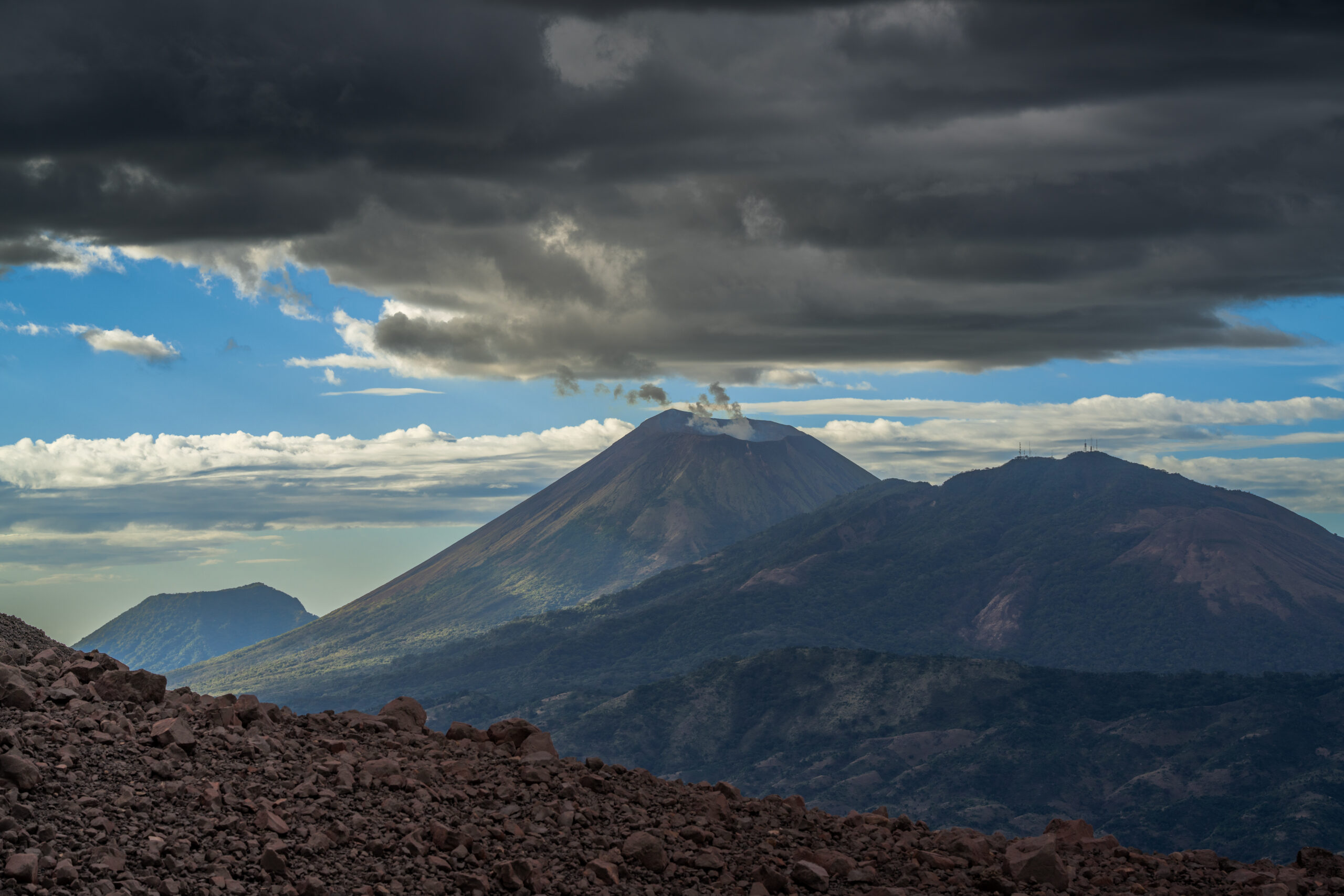
At 1,745 meters, San Cristóbal is the highest and one of the most active volcanoes in Nicaragua. From a distance, its almost perfect cone looked serene, but the climb itself was a completely different story. The journey to the top was one big attack on a steep and very slippery volcanic slope, covered in ash and loose debris. You take a few steps up and then you slide back down a bit. With no shade, in the heat and sulfurous air, it was a truly hellish journey in places.

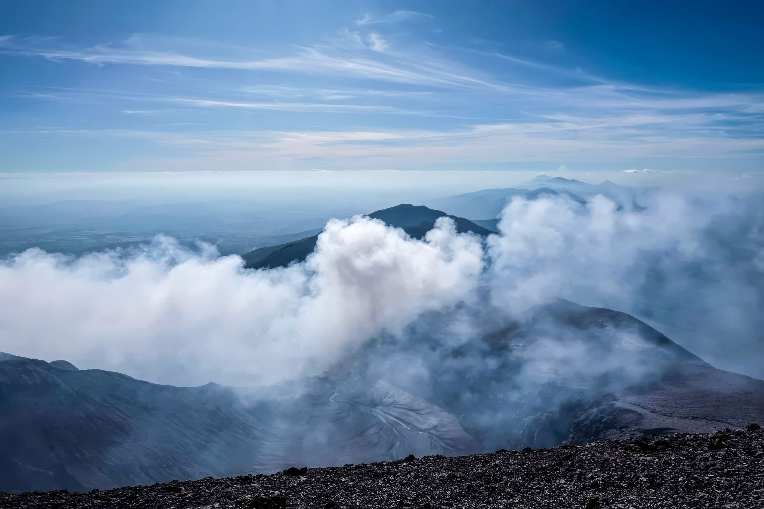
But at the top, you quickly forget about the fatigue. A huge smoking crater opened up in front of us, and behind it, views of the entire chain of Nicaraguan volcanoes, the green plains of Chinandega, and the distant Pacific. This view made the whole hell worth it.
Popis druhé fotografie Popis první fotografie Popis třetí fotografie

How to get there?

The climb is usually organized from Chinandega or León, from where an off-road vehicle will take you to one of the starting points below the volcano. The route is not well marked and San Cristóbal is still active, so it is wise to go with a local guide who knows the current conditions. Expect a full-day and physically demanding climb, starting early in the morning because of the heat later.
↑ Back to map

Matagalpa

Matagalpa is located in the green mountains of northern Nicaragua and is one of the places where many foreign tourists do not go. Immediately after arriving, I was surprised by the air here. It smelled strangely of coffee, tobacco and cigars, which are inherent to this part of the country. The surrounding slopes are covered with coffee plantations and clouds often hang over the city, thanks to which the climate here is more pleasant than in the hot lowlands.

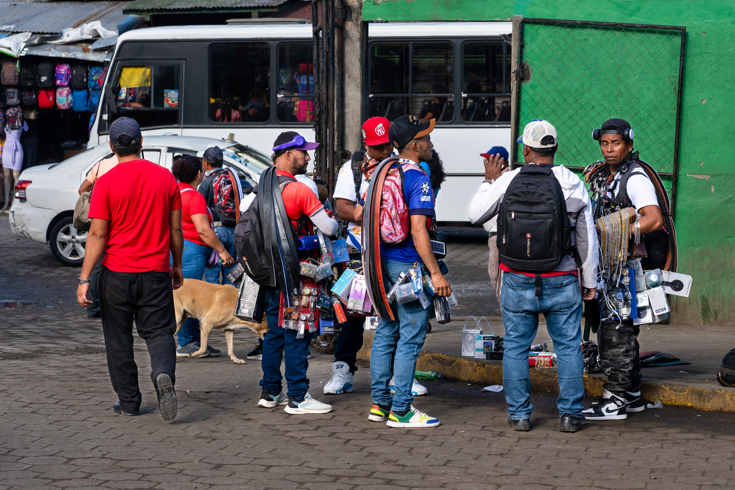
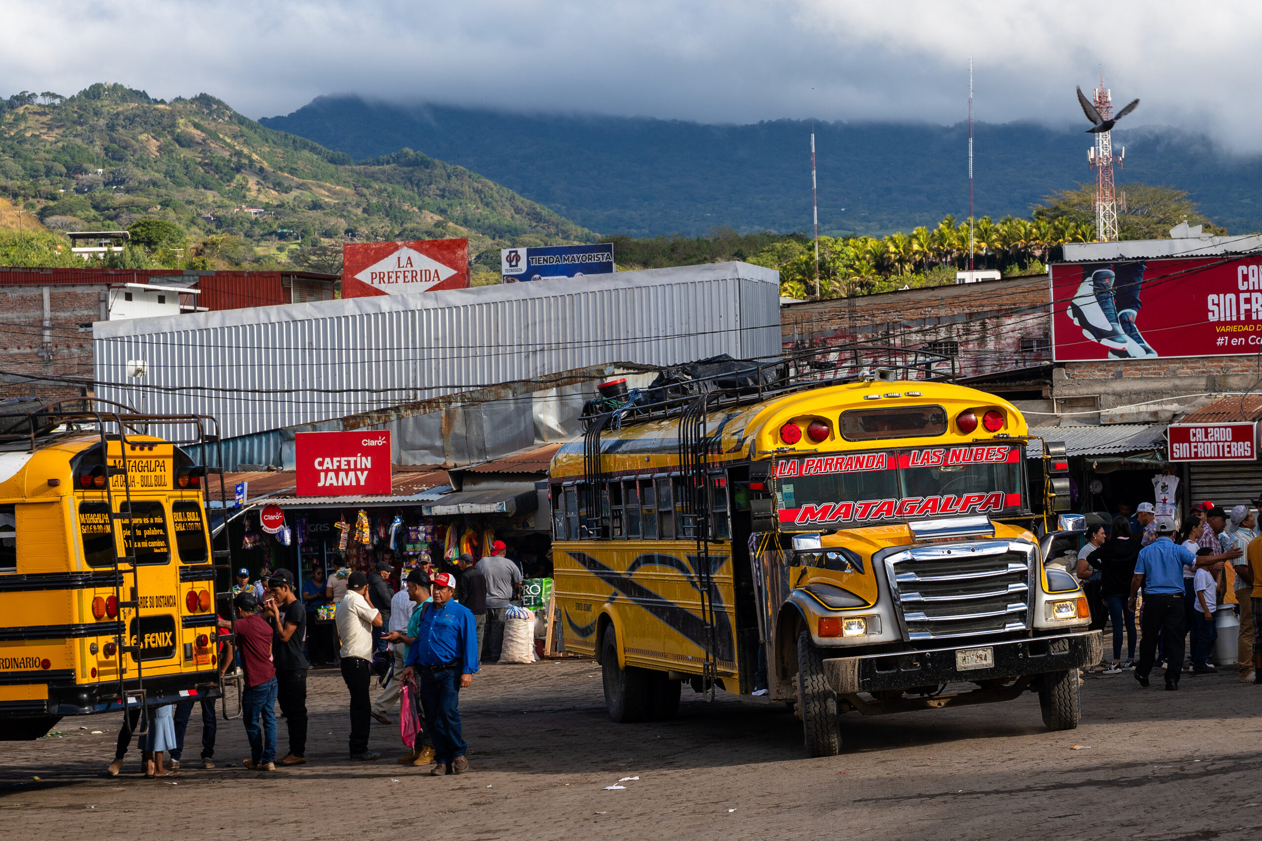
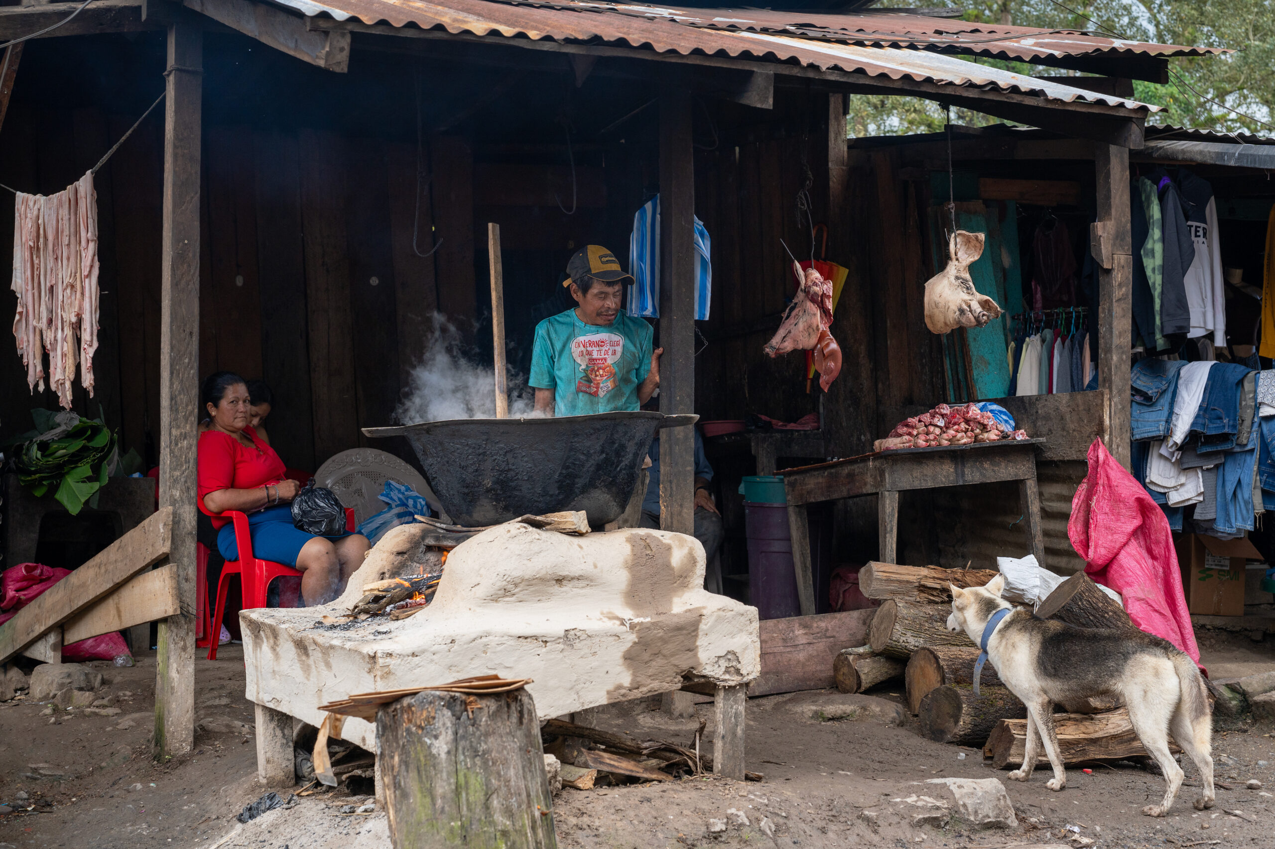
Walking through the city, I had the feeling that nothing was being embellished here. In the markets, cuts of meat were hanging right by the road, people, buses and goods were crowded between the stalls, and the daily bustle of the open workshops was heard. Matagalpa did not try to please. But that is precisely why I was able to get to know Nicaragua as it really is.
Popis první fotografie Popis druhé fotografie Popis třetí fotografie

How to get there?

Direct chicken buses and faster express buses run to Matagalpa from the Mercado Mayoreo terminal in Managua. The journey takes approximately three hours. Connections also operate from León, Estelí and other cities in northern Nicaragua, sometimes with a transfer.
↑ Back to map

Peñas Blancas

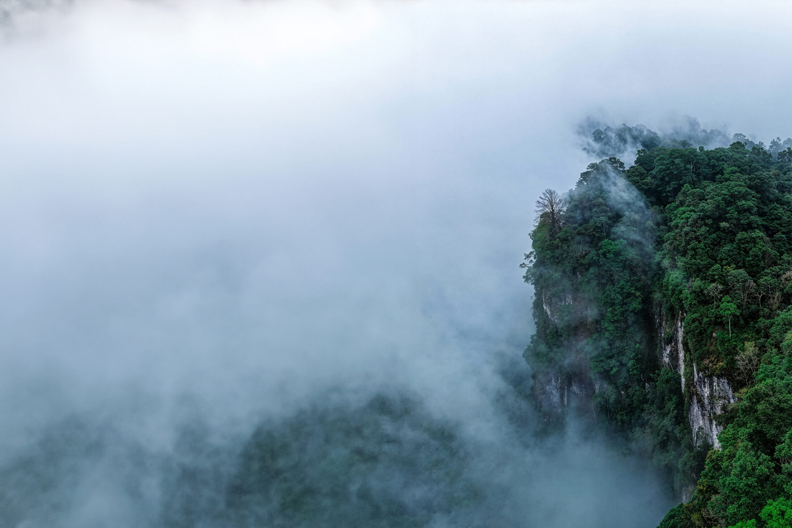
The Peñas Blancas massif was hidden in the clouds for most of the time. The white rock walls appeared for a moment above the green slopes and then disappeared again in the fog. Ferns, mosses and huge leaves soaked in water grew all around, between which narrow waterfalls fell from the mountains. After the hot lowlands of Nicaragua, I suddenly found myself in a cold and humid world, where almost everything dripped, rustled and smelled like a rainforest.

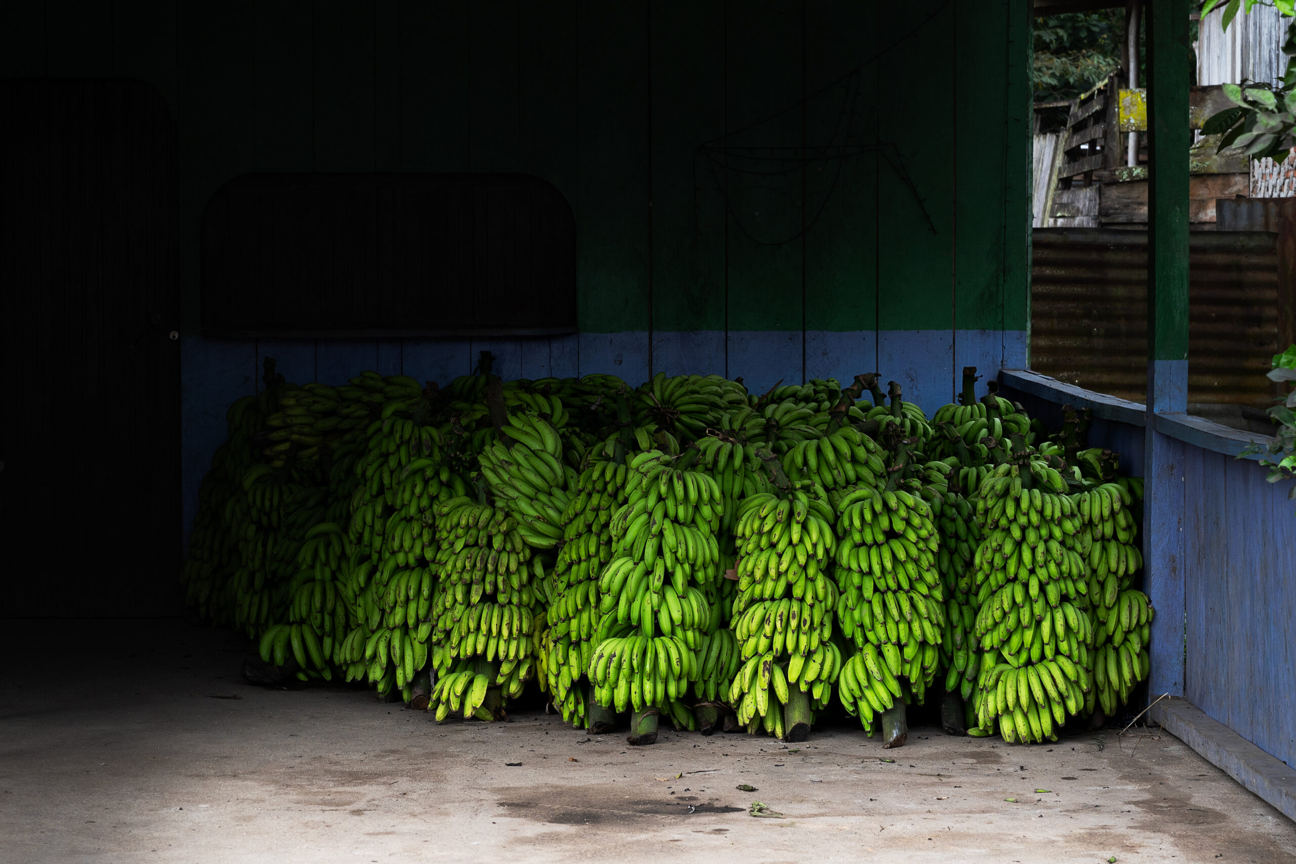
At the foot of the mountains, small villages alternated with coffee and banana plantations, mainly bananas for cooking. The people here live mainly from what they grow on the steep slopes, and the coffee from Peñas Blancas is among the best you can taste in Nicaragua. Tourists come here at a minimum, and in the evening the entire valley is plunged into darkness and silence, from which only the rain, insects and distant voices from the surrounding farms can be heard.
Popis první fotografie Popis druhé fotografie Popis třetí fotografie

How to get there?

From the Guanuca bus station in Matagalpa, take a chicken bus towards El Cuá or Bocay and get off at the Empalme La Manzana intersection. The journey takes approximately three hours and the last few hundred meters are on foot to the community of Peñas Blancas. Check the return bus times on site, as the last buses leave in the afternoon.
↑ Back to map

Los Zorros

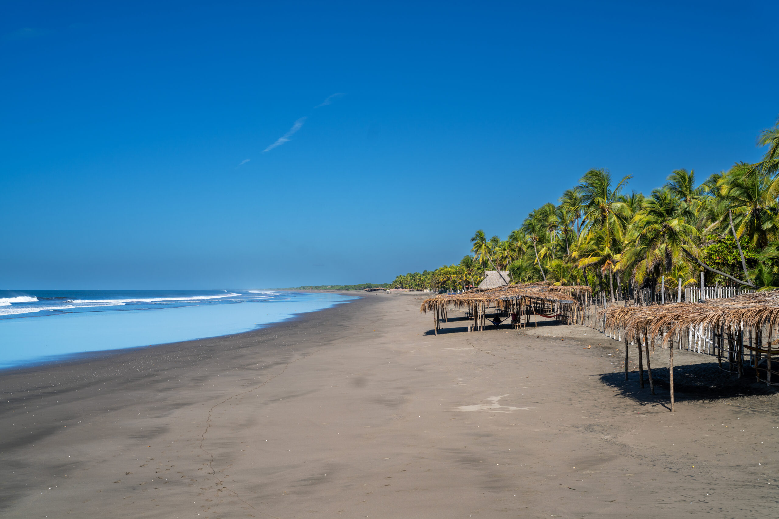
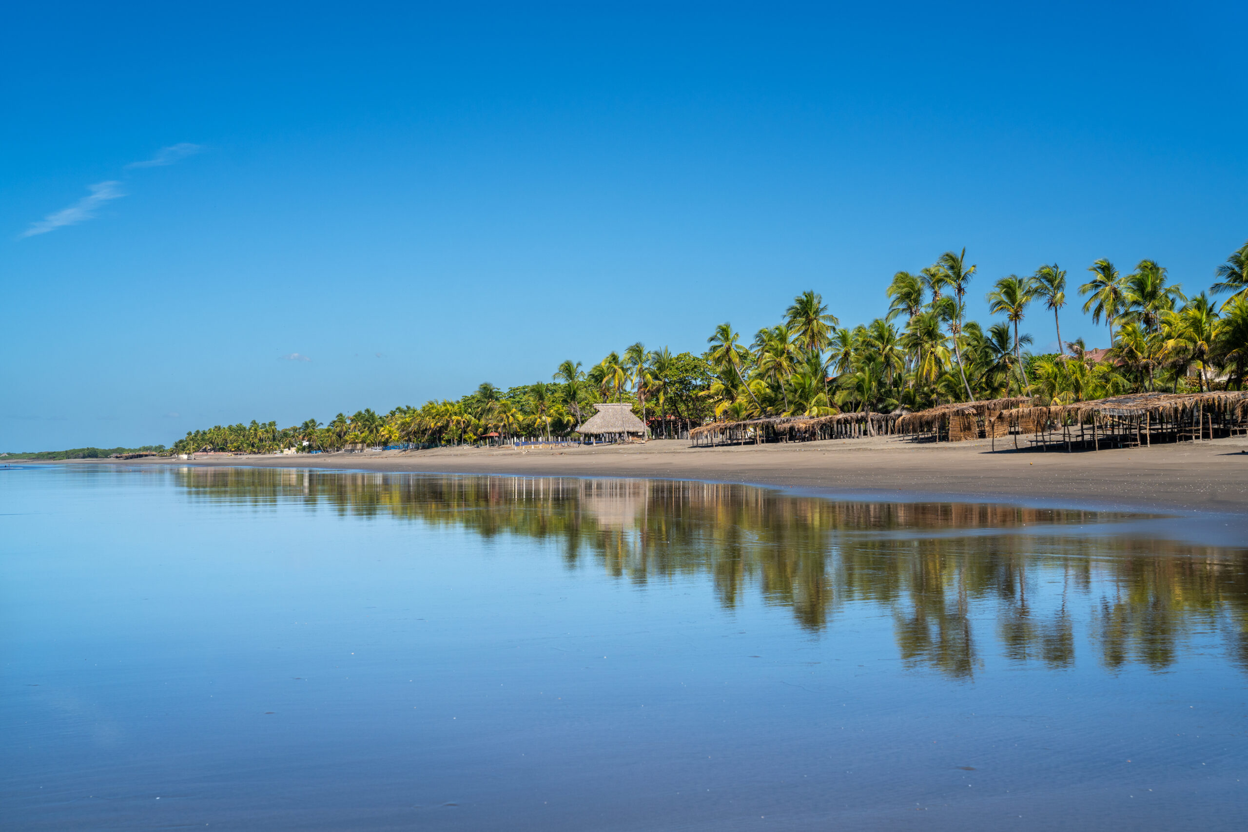
Los Zorros is a long stretch of dark sand on the northern coast of Nicaragua that most foreign tourists never get to. There are already a few small resorts and simple restaurants along the beach, but their guests are mainly local families. As I walked along the coast, the roar of the Pacific almost drowned out everything else. It was hot, empty and raw, a completely different world from the famous resorts in the south of the country.

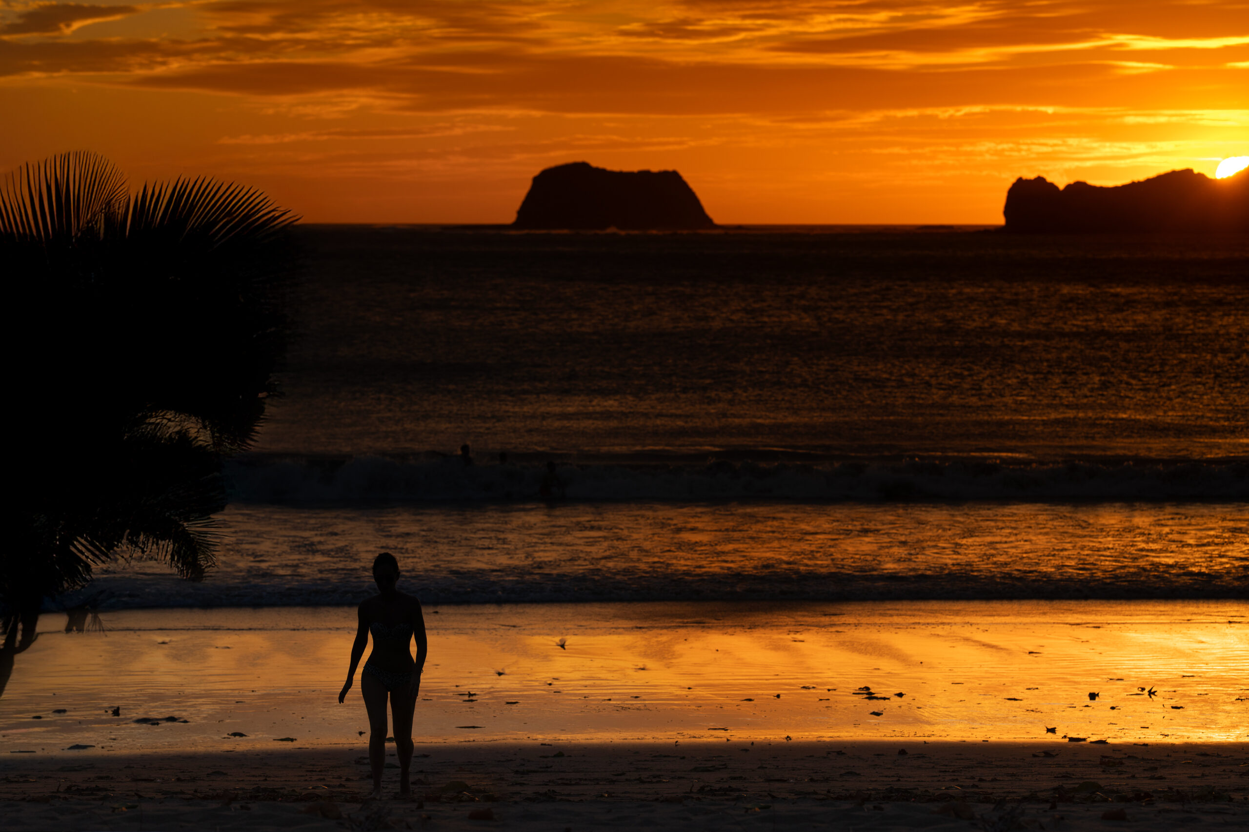
Nearby, the ocean meets the mangroves of the Estero Padre Ramos reserve. On one side, the waves crash, on the other, the water, filled with birds, crabs and fishing boats, spills almost motionlessly between the roots of the mangroves. The best time comes in the evening, when the sun slowly sinks into the Pacific and the wide beach is almost empty.
Popis první fotografie Popis druhé fotografie Popis třetí fotografie

How to get there?

From Chinandega, take a chicken bus to El Viejo and from there take a local bus or collectivo to Jiquilillo. Los Zorros is further north along the coast and the last part of the journey is easiest to do by taxi, local shuttle or walking along the beach. Check return times in advance as transport in this area ends quite early. ↑ Back to map

Ometepe

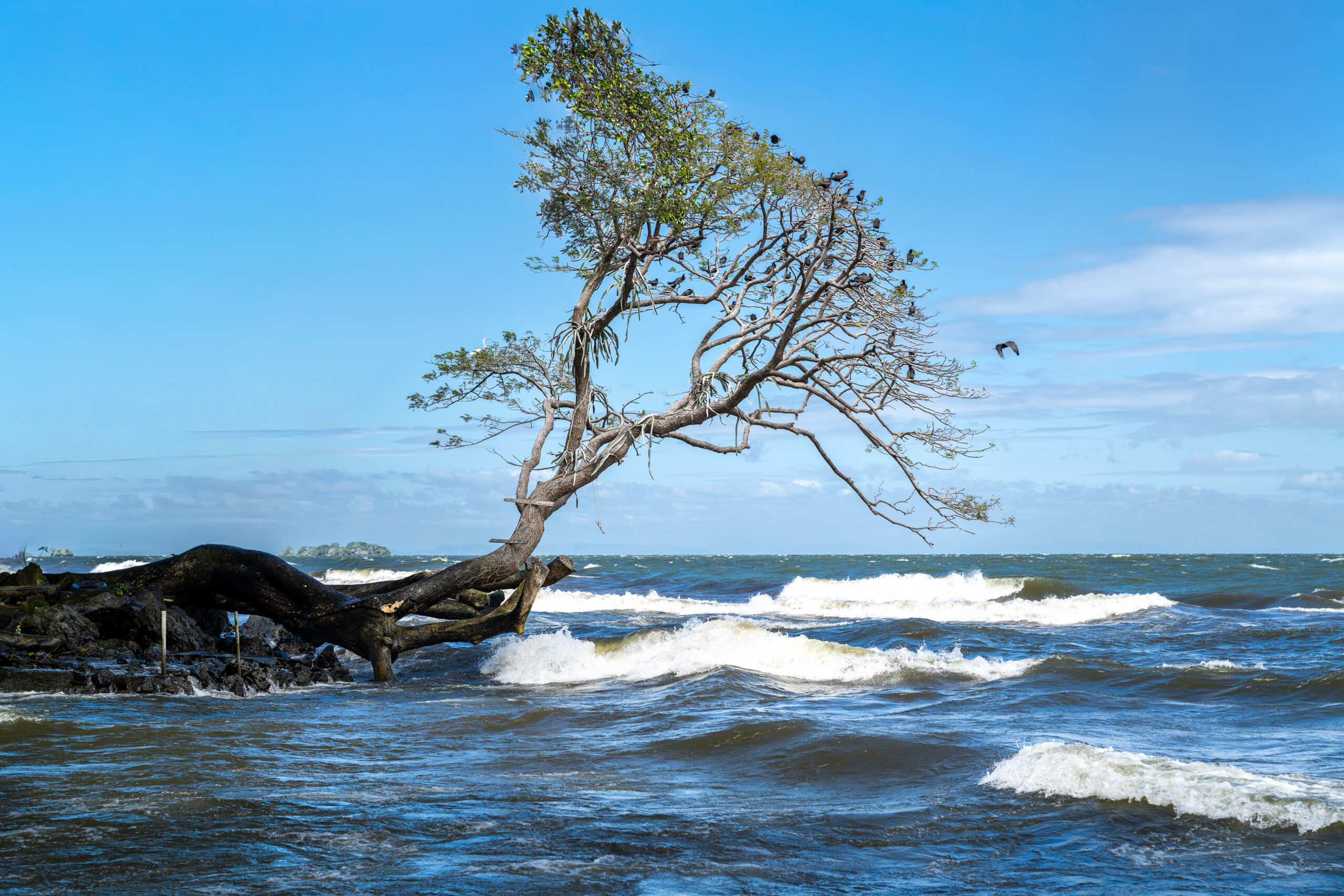
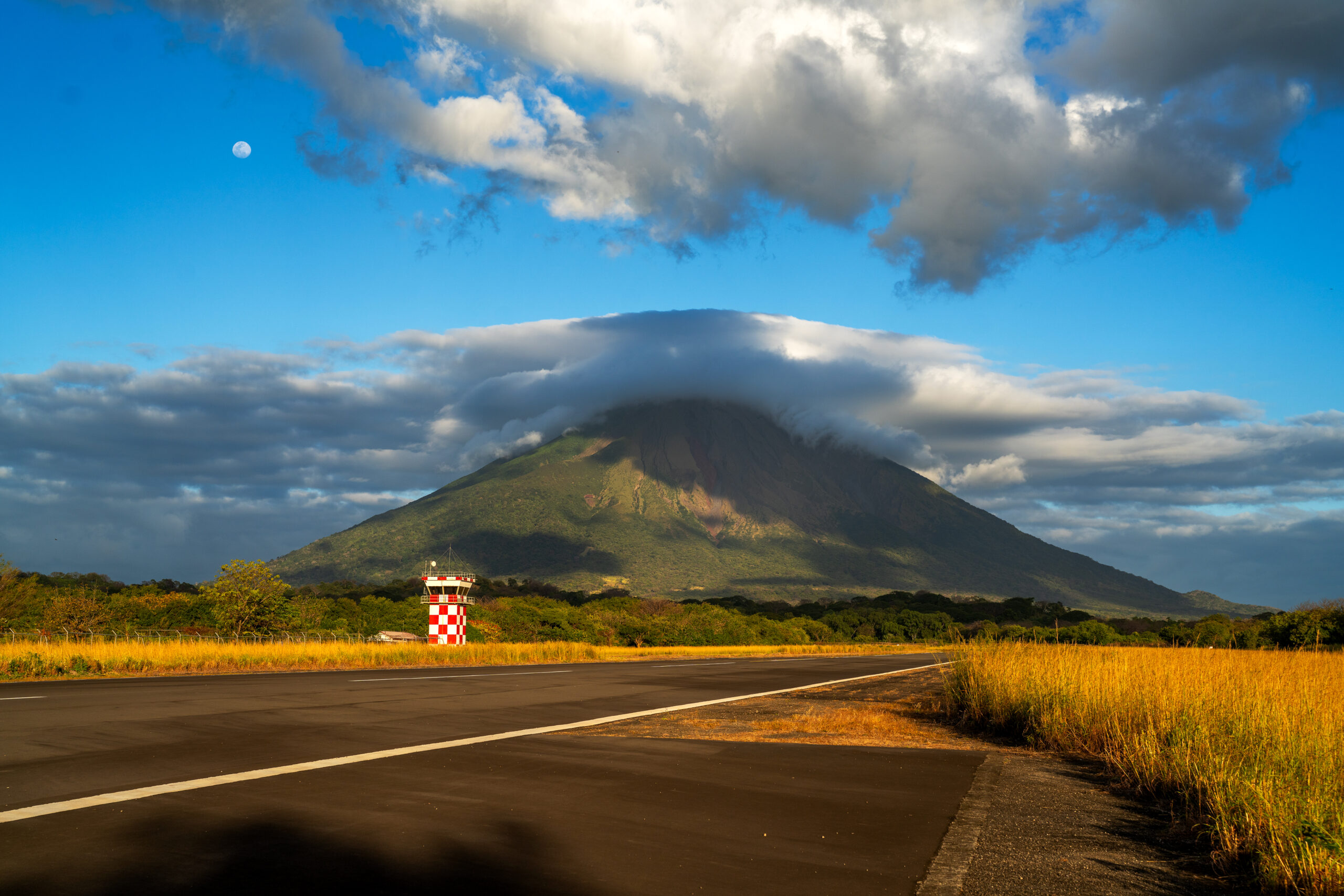
Ometepe appears above the surface of Lake Nicaragua long before the ferry arrives at the port. On one side rises the almost perfectly regular cone of the active volcano Concepción, on the other the green Maderas, whose peak is hidden in the clouds most of the time. Two completely different volcanoes connected by a narrow strip of land have created an island that already seems a bit surreal upon arrival.

While hiking Ometepe, I had both volcanoes almost in front of my eyes. One of my top experiences in Nicaragua was supposed to be climbing Concepción. But nature had a different opinion. The steep hike was great, but I climbed most of the time in thick fog, so in the end it was more about the journey itself than the views. Even so, the climb had its charm, and I felt the power of the volcano even more intensely in the fog.

Although the island has long been discovered by tourists, it still maintains a slow, rural rhythm outside the main areas. In the evening, just walk to the lake and watch the sun disappear behind the water and the two volcanoes gradually disappear into the darkness.
Popis první fotografie Popis druhé fotografie Popis třetí fotografie

How to get there?/h4>

From Rivas, take a bus or taxi to the port of San Jorge. From here, ferries and smaller boats leave several times a day for Moyogalpa and San José del Sur, the journey takes about an hour. You can get around the island by chicken bus, taxi or by renting a motorbike or scooter.
↑ Back to map

Granada

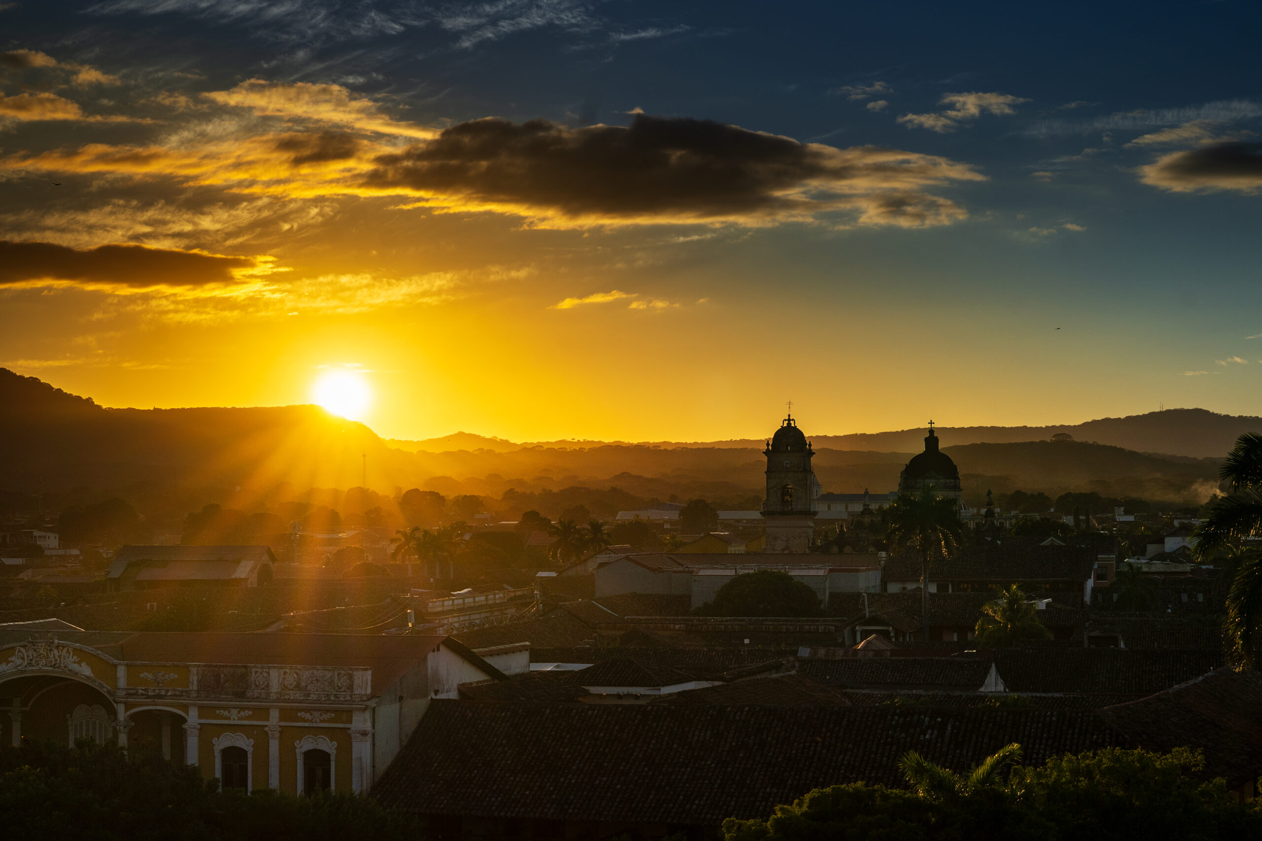
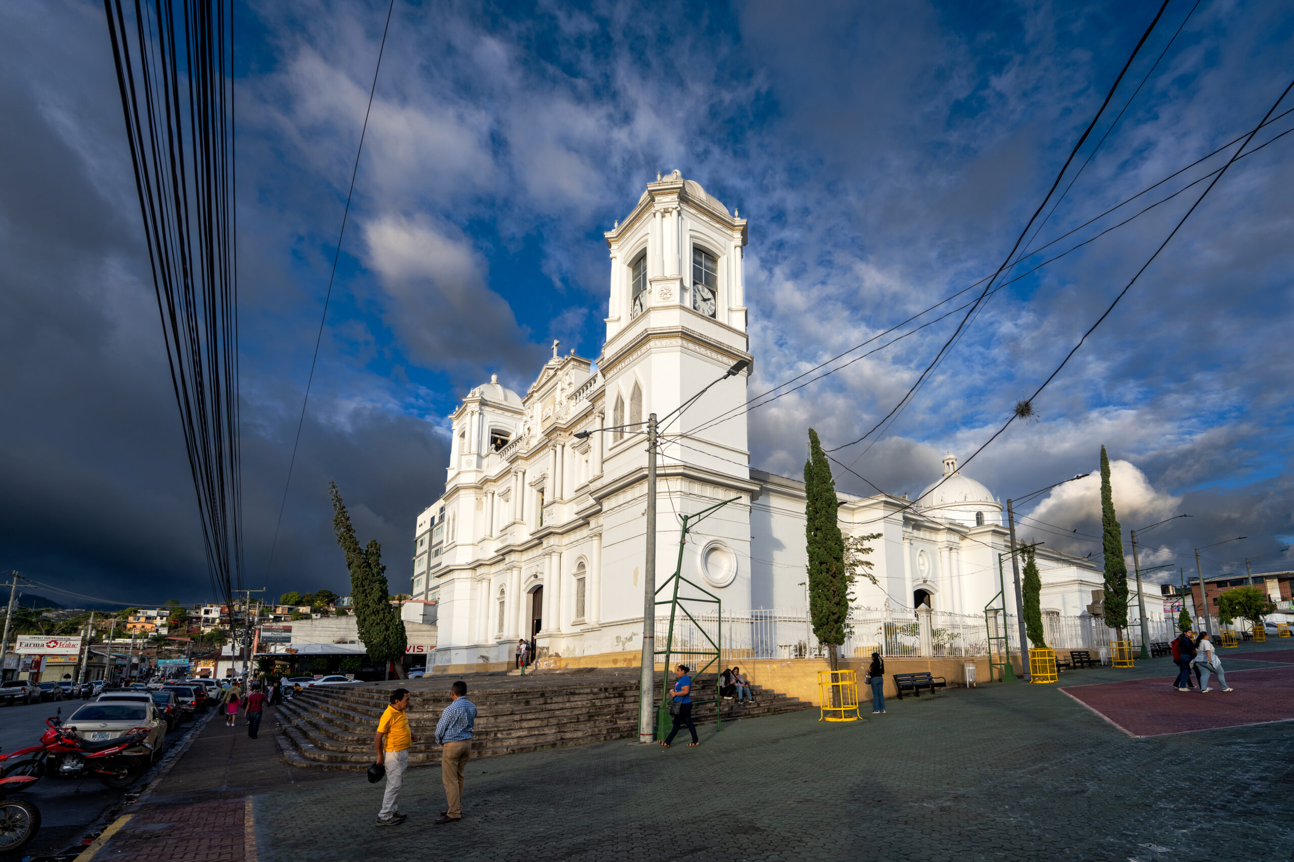
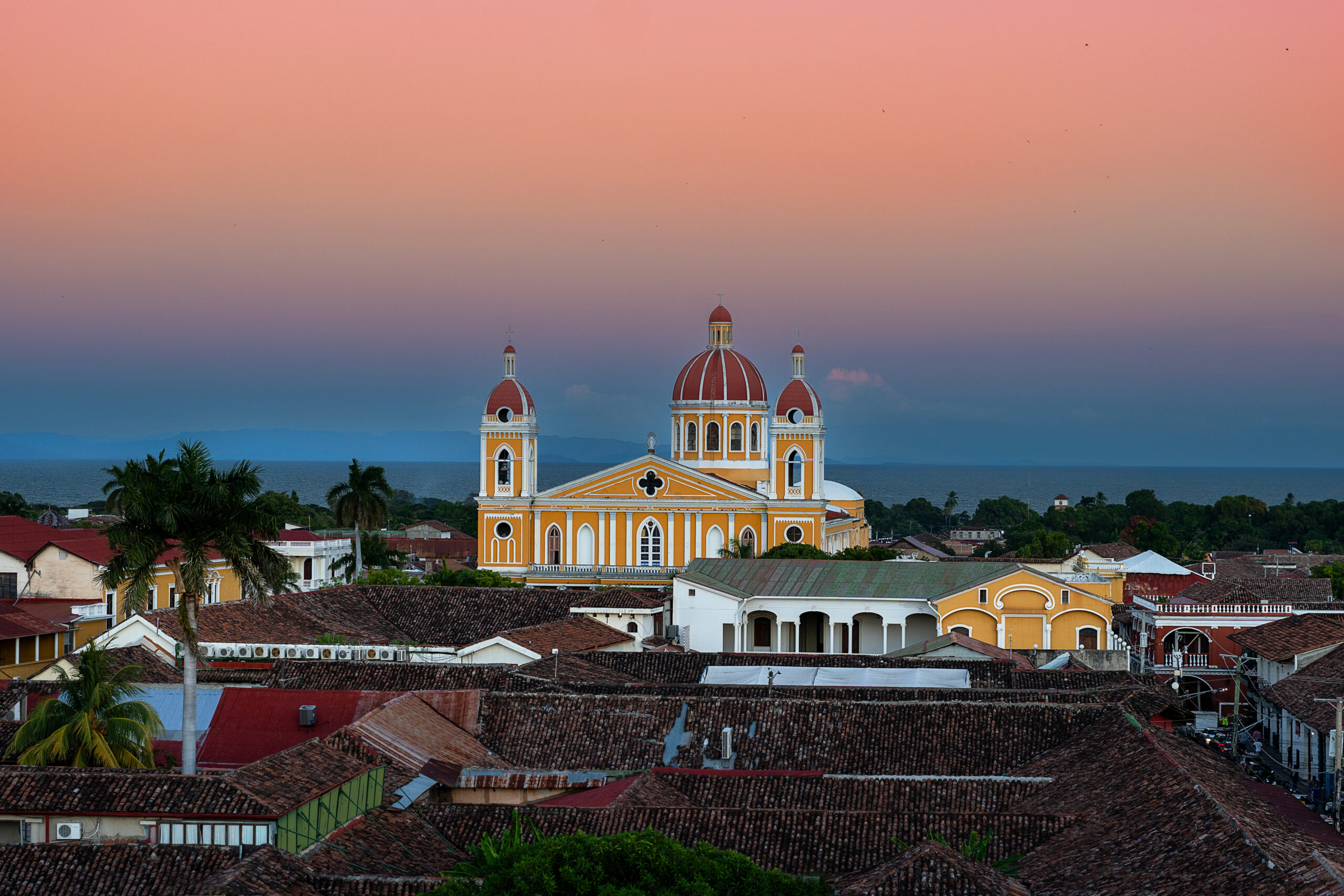
Granada is one of the oldest and most beautiful cities in Central America. The colorful facades, cobblestone streets, and historic churches create an atmosphere that I could walk around for hours without a specific destination. The cathedral in the main square dominates, but once you get off the touristy streets, the city quickly reveals a different face.

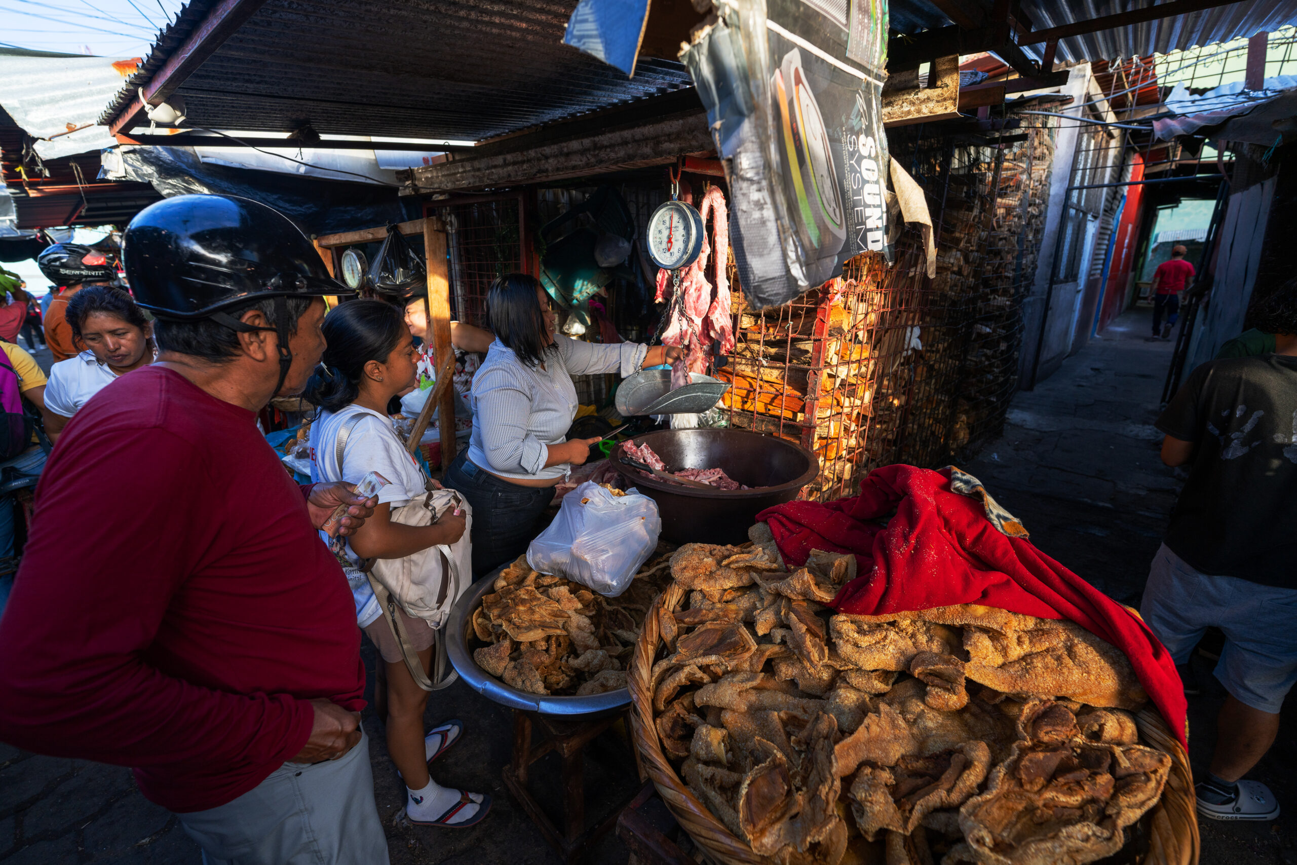
I enjoyed the huge local market the most, where people, carts and buses crowded between the stalls with fruit, meat, clothes and everything necessary. In the afternoon I looked from the tower of the La Merced church over the red roofs to the Mombacho volcano. Just a short distance from the city lie hundreds of Isletas, between which you can sail by boat past fishermen, waterfowl and houses hidden in tropical vegetation.
Popis první fotografie Popis druhé fotografie Popis třetí fotografie

How to get there?

From Managua, direct minibuses run to Granada from the Casimiro Sotelo terminal, formerly known as UCA, and the journey takes approximately one and a half hours. Regular bus services also operate from Masaya and Rivas. Boats depart for the Isletas from a pier on the lake a few kilometres from the centre of Granada.
↑ Back to map

León

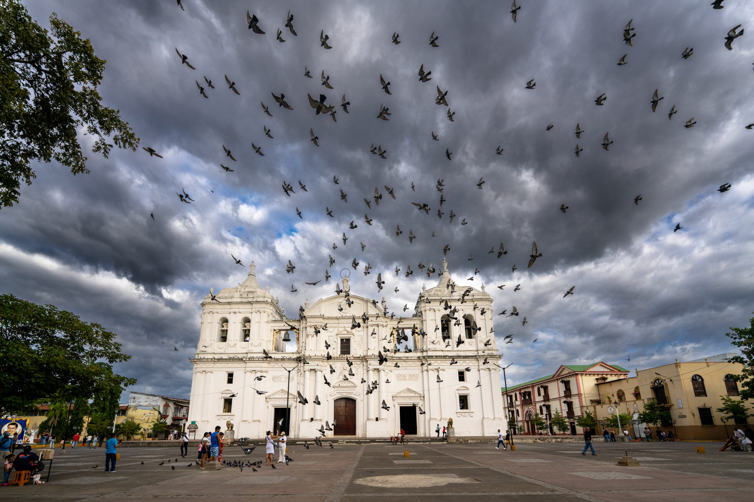
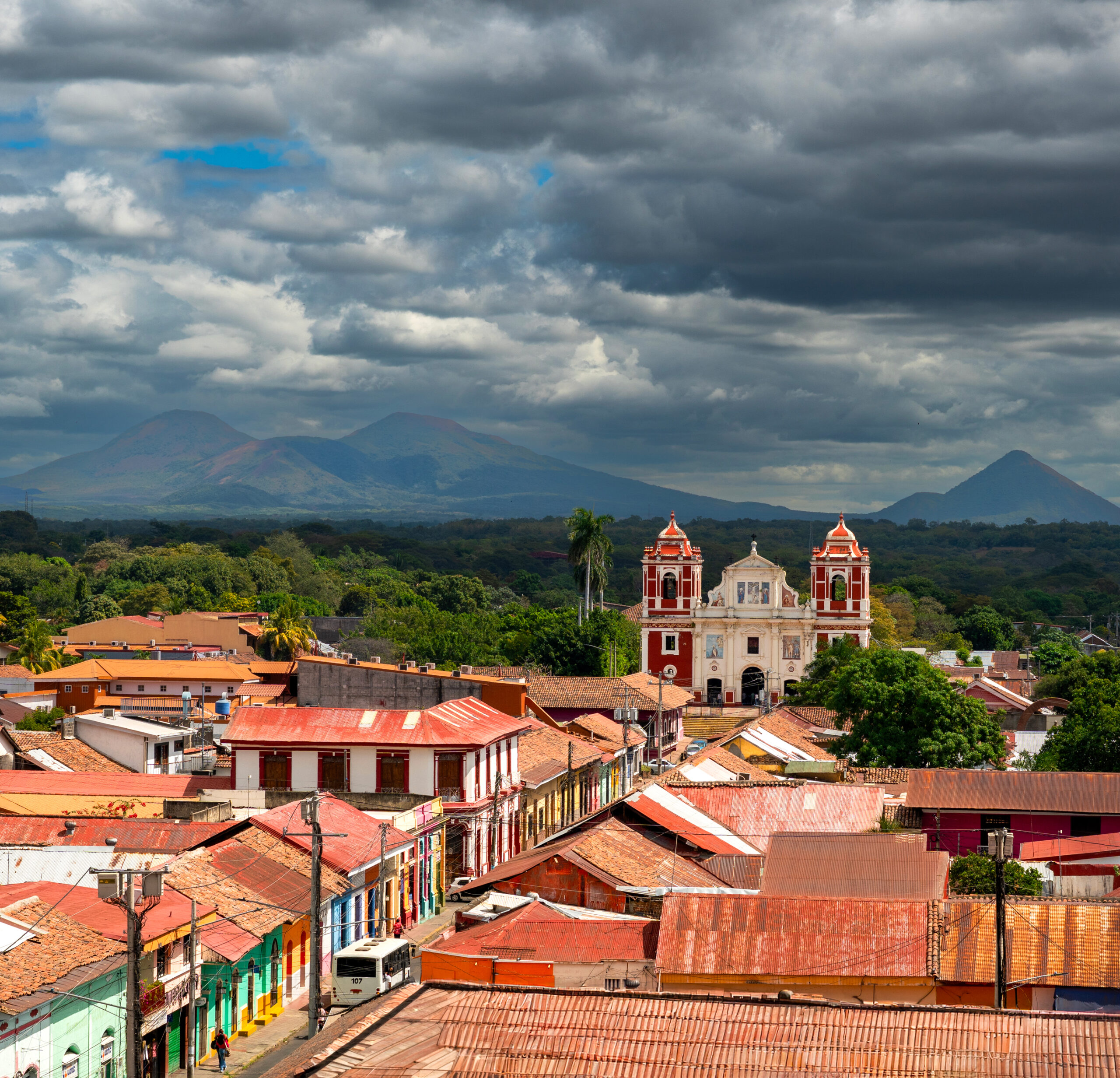
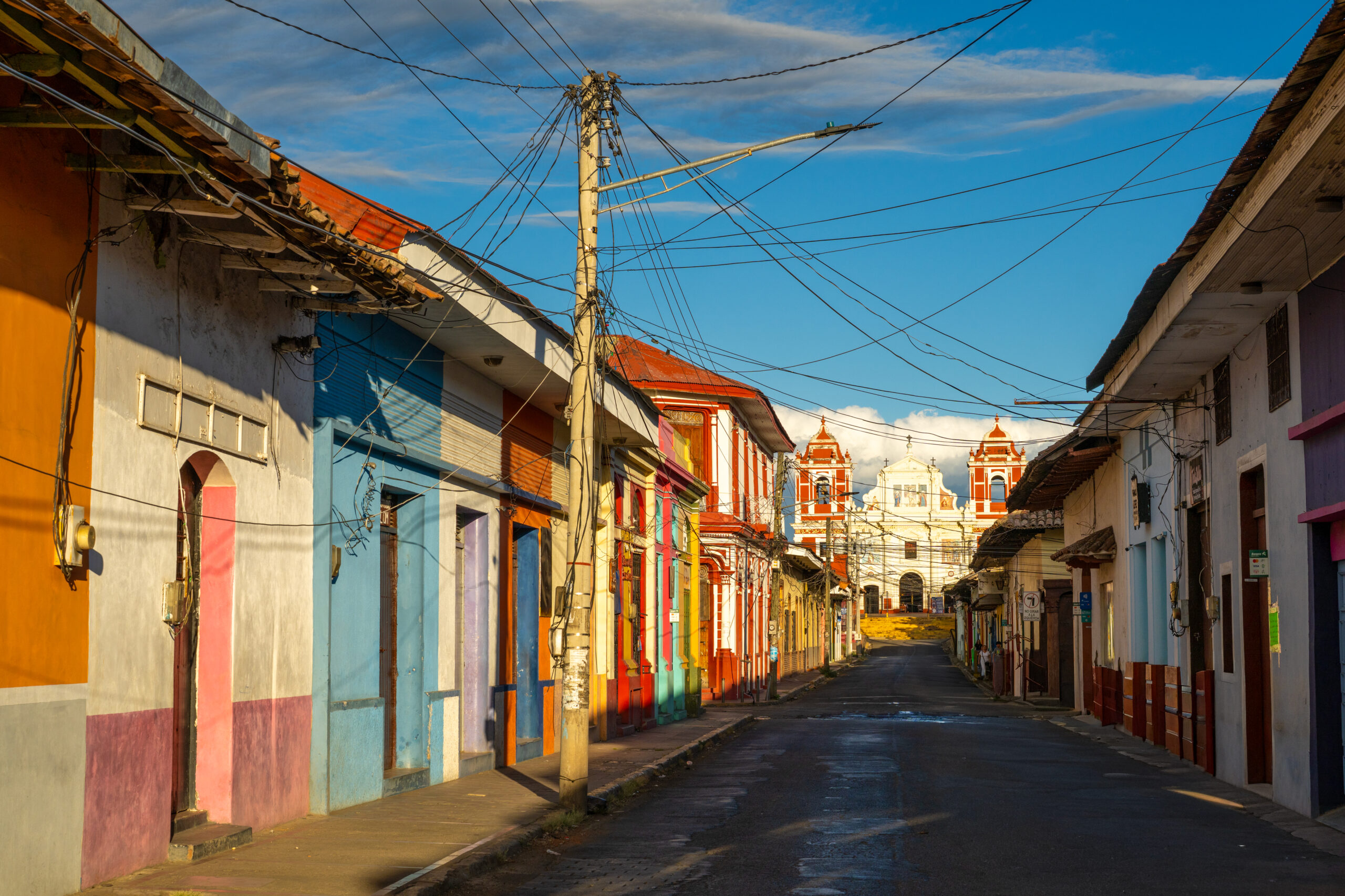
León seems more raw and restless than the more polished Granada. A massive white cathedral rises above the colorful streets, from whose roof I had a view of the city and the surrounding chain of volcanoes. The revolution is still present here in murals, monuments, bullet holes and stories of former Sandinista fighters. But damn the revolution. León is different mainly in terms of people. It is a bit messy, noisy and imperfect, but that is what makes it its own. Of all the Nicaraguan cities, it probably had the strongest genius loci for me.

León was originally located in a completely different place. The first city was founded by the Spanish in 1524 on the shores of Lake Managua, directly under the Momotombo volcano. After a series of eruptions and a devastating earthquake, the inhabitants abandoned it in 1610 and moved to its current location.
Popis první fotografie Popis druhé fotografie Popis třetí fotografie

How to get there?

From Managua, there are direct minibuses from the Casimiro Sotelo terminal to León and cheaper chicken buses from the Israel Lewites terminal, the journey takes approximately two hours. To León Viejo, continue by bus to La Paz Centro and from there by local bus or taxi towards Puerto Momotombo.
↑ Back to map

Volcano Masaya

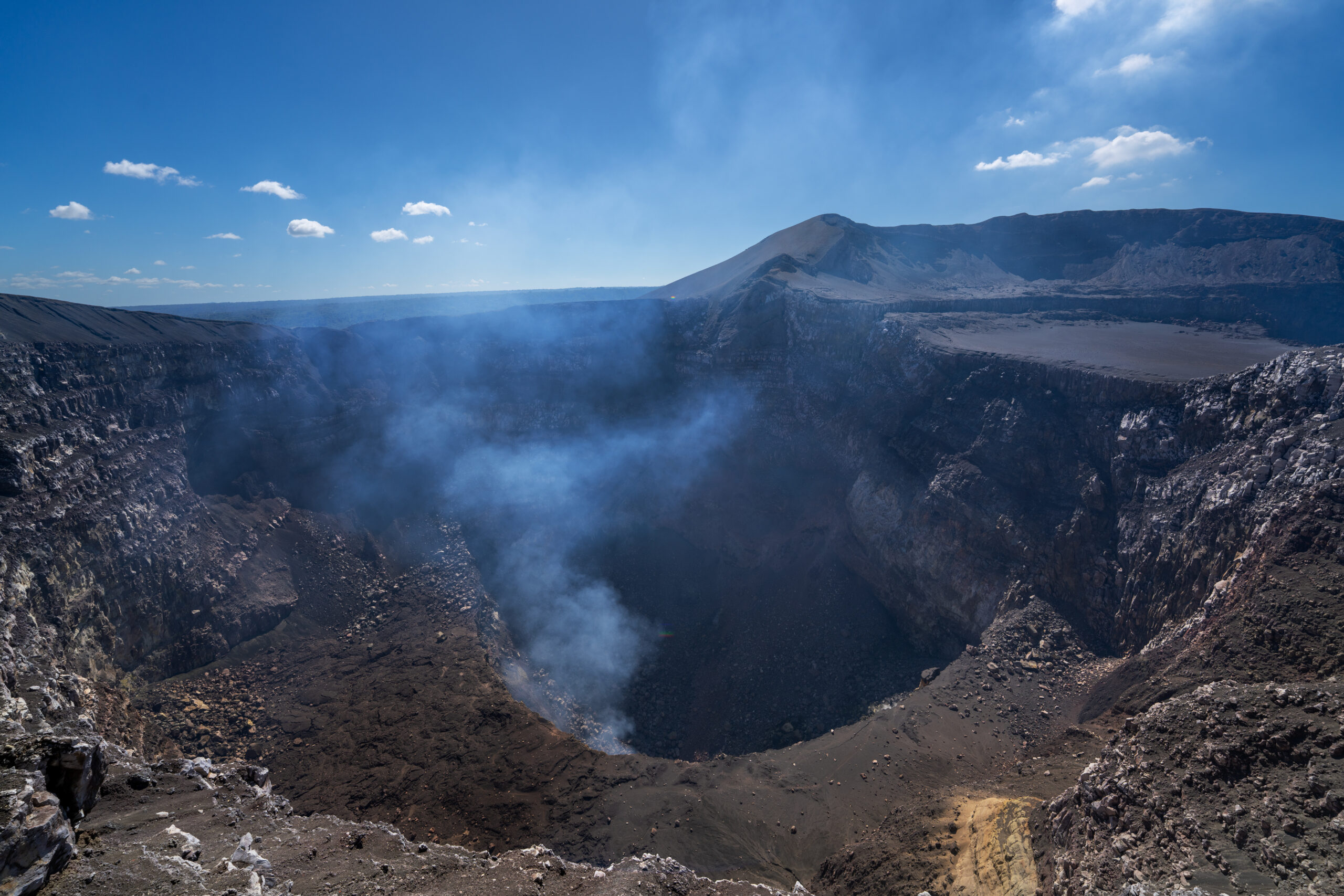
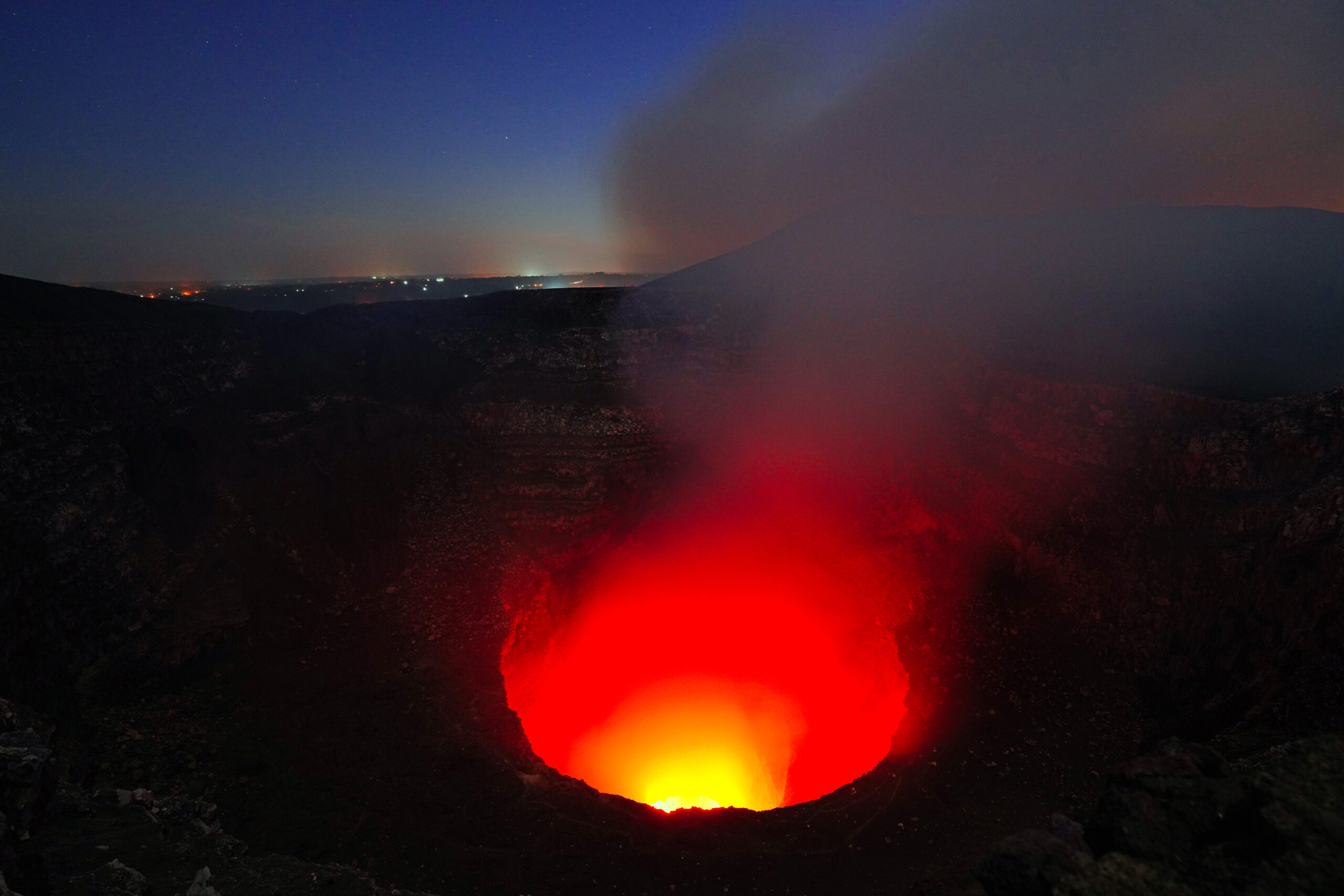
Masaya doesn't look like a classic volcano that you have to climb for hours. I drove almost to the edge and after exiting, a huge hellish hole in the ground opened up in front of me. Smoke was rising from the Santiago crater, the air smelled of sulfur, and deep below me, lava was glowing and moving. I just stood on the edge and watched in disbelief what was happening inside the earth.

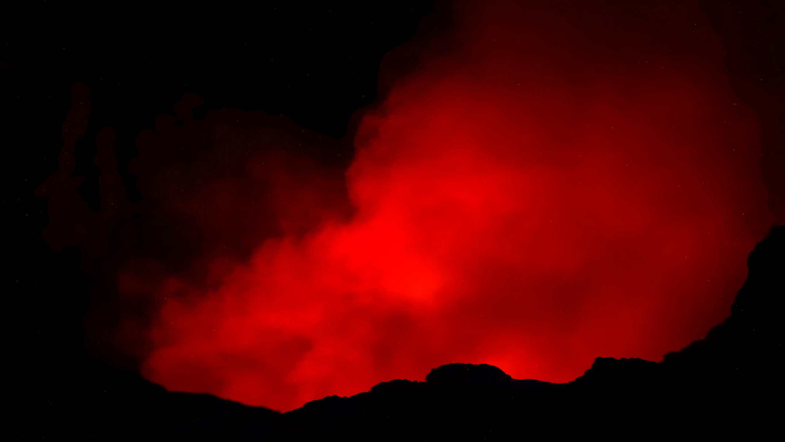
The natives considered the crater a gateway to the underworld, and the Spanish conquistadors called it La Boca del Infierno, the Mouth of Hell. As I watched the red glow illuminating the smoke rising from the depths after dark, I was not surprised at all. This place truly felt like an open gateway to hell.
Popis první fotografie Popis druhé fotografie Popis třetí fotografie

How to get there?

The Masaya national park is located on the main road between Managua and the city of Masaya. You can take a bus to the park exit, but it is still a few kilometers from the crater entrance, so it is easier to use a taxi, your own car or an organized tour. Access to the crater and evening visits vary depending on the current volcanic activity, so check the park opening times in advance.
↑ Back to map

Views: 0

September 20, 2026 0 comments
0 FacebookTwitterPinterestOdnoklassnikiRedditEmail
Namibia

Namibia: A Land of Deserts, Wildlife and Endless Horizons

by Petr Hingar July 21, 2026
written by Petr Hingar
Twenty years later,
Namibia still feels remarkably unchanged.

Of course, time has left its mark. Cities have expanded, tourism has grown, and new lodges and roads have appeared across the country. But unlike many destinations that have transformed beyond recognition, Namibia has held on to its greatest asset: an extraordinary sense of space.

Here, endless gravel roads disappear into the horizon, settlements are few and far between, and you can drive for hours without seeing another person. That feeling of freedom is what keeps drawing me back.

OUR NAMIBIA: DUST, STARS AND THOUSANDS OF KILOMETRES THROUGH THE MIDDLE OF NOWHERE

This journey was a little different from the way I usually travel. We rented a Toyota Fortuner 4×4, slept either in a rooftop tent or in simple lodges, and every evening grilled excellent – and surprisingly inexpensive – meat. During the day we baked in the heat, while at night, photographing the Milky Way, we shivered in temperatures dropping to –3 °C.

We carried fifteen litres of water in the car, drove along roads that don’t even have an equivalent classification in Europe, and suffered only one puncture during the entire trip.

Every day we ate biltong, drank local beer and swallowed clouds of dust. We experienced rain in the desert, clouds hanging almost to the ground, frost covering our tent and landscapes cracked by drought. We were woken at night by the incoming tide, the grunting of hippos and the trumpeting of elephants. We saw an incredible variety of wildlife, from elephants, cheetahs and hippos to elegant oryx. We stood on dunes that plunge straight into the Atlantic Ocean, wandered through abandoned diamond fields, crossed the endless wilderness of Damaraland and Kaokoland, admired the Epupa Falls on the Angolan border, and ended almost every day watching the sun disappear over landscapes where silence was often the only companion.

Namibia isn’t about ticking off landmarks. It’s about the drive between them. Endless gravel roads, vast empty landscapes and the feeling that the next horizon always hides another adventure.

That said, it’s important to remember that distances are enormous. Most roads are gravel, while some sections are rocky or sandy, and average speeds are often much lower than your map suggests. Outside the towns, mobile phone coverage frequently disappears, leaving you surrounded by nothing but desert, mountains and dry riverbeds for dozens of kilometres.

Yet perhaps because of that, Namibia is one of the world’s greatest road-trip destinations. In a single journey you can climb some of the highest sand dunes on Earth, drive through landscapes inhabited by elephants, watch hippos along the Okavango River, stand beside waterfalls on the Angolan border, and just a few days later witness the giant dunes of the Namib Desert plunging directly into the cold Atlantic Ocean.

General Information

WHEN TO GO

The best time for a self-drive trip is from May to October when the weather is dry, wildlife gathers around waterholes and most roads are in excellent condition. Keep in mind, however, that in June and July nighttime temperatures in the desert can easily fall below freezing.

HOW LONG SHOULD YOU STAY?

For a first visit, I recommend at least 10–14 days, although three weeks is ideal if you also want to explore Damaraland or Kaokoland beyond the main highlights. The less you rush, the more you’ll enjoy the journey itself.

DAILY BUDGET

Car rental, accommodation and fuel are usually the biggest expenses, while food from supermarkets or campsites is surprisingly affordable. Combining camping with simple lodges makes travelling significantly cheaper than staying exclusively in safari lodges.

VISA

EU citizens require a visa to enter Namibia. It can be obtained through the <strong>Visa on Arrival</strong> system or applied for online before departure. Always check the latest entry requirements on the official Namibian government website before travelling.

GETTING TO NAMIBIA

Most travellers fly into ‘Windhoek’, either on a direct flight from Germany or Switzerland, or with one stop via one of Africa’s major hubs. If your flight arrives in the evening, I recommend spending your first night in Windhoek before starting your road trip the following morning.

GETTING AROUND NAMIBIA

Namibia is one of the world’s best road-trip destinations, and without your own vehicle you’ll miss many of its most spectacular places. A regular SUV is sufficient for the classic circuit, but for Kaokoland or the more remote parts of Damaraland, a proper 4×4 is highly recommended.

SAFETY

Namibia is one of the safest countries in Southern Africa and, provided you follow basic precautions, you’ll generally feel very safe throughout your trip. The biggest danger isn’t the wildlife—it’s driving too fast on gravel roads, the vast distances, and driver fatigue.

ACCOMMODATION & FOOD

From remote bush camps and simple campsites to luxurious safari lodges, Namibia offers accommodation for every style of traveller. If you’re planning to visit Etosha or Sossusvlei, however, book several months in advance.

Our Journey Across Namibia

Our route began in Windhoek and headed south through Keetmanshoop, Aus and Lüderitz. From there we followed the legendary D707 to the dunes of Sossusvlei, continued to the coast at Walvis Bay and Swakopmund, and then travelled north via Spitzkoppe, Damaraland, Kaokoland and the Epupa Falls.

Next came Etosha, the Hoba meteorite, the Kavango region, Bwabwata National Park and the Okavango River. After several thousand kilometres, we returned to Windhoek through central Namibia.

Some of these places rank among the most famous destinations in Africa. Others lie well away from the main tourist routes. And, more often than not, it was those hidden places that impressed us the most.

My Personal Top 6 Places in Namibia

Choosing just six places wasn’t easy. But if I had to rank them purely by the strength of the experience they gave me on this journey, my personal list would look like this:

  1. Kaokoland
  2. Damaraland
  3. Bwabwata & the Okavango River
  4. Roads C43 a D3700
  5. Kolmanskop
  6. Sandwich Harbour

Kaokoland

For its remoteness, magnificent gravel roads, the Kunene River and the feeling that you've reached the very edge of the world.

Damaraland

For its endless open spaces, rocky plains, desert elephants and landscapes that still feel almost untouched.

Bwabwata a řeka Okavango

Because it reveals a completely different side of Namibia—water, hippos, elephants and unforgettable evenings by the river.

Silnice C43 a D3700

Because here the drive itself is a greater experience than the destination. Endless views, complete isolation and a remarkable sense of freedom.

Kolmanskop

For its history, extraordinary light and a ghost town slowly being reclaimed by the desert.

Sandwich Harbour

Because there are very few places on Earth where giant sand dunes plunge directly into the Atlantic Ocean.

Quiver Tree Forest: Trees That Aren’t Really Trees

We began our journey in southern Namibia. One of our first stops was Quiver Tree Forest near Keetmanshoop—a place where quiver trees grow.

Although they're commonly called trees, they're actually giant aloes. Their pale trunks and twisted branches create an almost surreal landscape against the harsh desert surroundings.

The most magical moment, however, comes after sunset. Ground that was scorching hot during the day transforms within hours into a place where temperatures drop below freezing. Above us stretched one of the most spectacular night skies of the entire trip, while in the morning our tent was covered with frost.

This was where I had originally hoped to photograph the Milky Way. Unfortunately, the full moon had other plans. I finally captured it much farther north.

Lüderitz & Kolmanskop: A Town Swallowed by the Desert

The road to Lüderitz crosses one of the most remote parts of southern Namibia. The first stop is Garub, home to a remarkable population of wild horses. No one knows exactly how their ancestors arrived here, yet they've survived the harsh desert conditions for generations. We were lucky enough to see several of them. To me, these horses symbolise true freedom—no fences, no saddles, just endless space and the wind in their manes.

Beyond Aus, the road gradually descends towards the Atlantic. The desert slowly changes colour, the sand becomes more abundant, and with every kilometre you can feel the ocean drawing closer. Lüderitz itself is a place of striking contrasts: German colonial architecture, the icy Atlantic, relentless winds and the desert beginning immediately beyond the town.

Just a few kilometres away lies Kolmanskop, a former diamond-mining town that has gradually been reclaimed by the desert.

Today, dunes pour through the windows and doorways of former homes, the hospital and the school. Every room is different, and the light changes continuously throughout the morning. That's exactly why Kolmanskop is considered one of Namibia's finest photography locations.

We also explored the surrounding diamond fields, where mining shaped the entire region for decades. Even today, it's a place where history, the desert and raw nature blend together in a truly unique way.

D707: When the Road Is the Destination

If I had to choose a single road worth returning to Namibia for, it might well be the D707.

On one side stretch the red dunes of the Namib Desert, while mountain ranges rise on the other. Between them runs a narrow gravel road where you can drive for hours without meeting another vehicle.

The D707 has no famous viewpoints or major attractions. The road itself is the attraction. Ever-changing light, endless vistas and landscapes that feel almost untouched by time make every kilometre unforgettable.

Sossusvlei & Dead Vlei: Icons of the Namib Desert

Sossusvlei is one of Namibia's most iconic destinations, and in reality it is even more impressive than photographs suggest. Throughout the day the giant dunes shift from deep crimson to brilliant orange, while the changing light creates an endless play of shadows across their slopes.

Its greatest icon is Dead Vlei—a white clay pan dotted with the skeletal remains of ancient camel thorn trees that have stood here for centuries. The contrast between the white clay, black trees, blue sky and red dunes creates one of Africa's most photographed landscapes.

Climbing one of the dunes is absolutely worthwhile, although the deep sand and rapidly rising temperatures make the ascent much more demanding than it first appears. Sunrise is by far the best time to visit, when the light is at its finest, temperatures are still pleasant and crowds remain small.

From the Desert to the Cold Atlantic

The journey from Sossusvlei to the coast reveals yet another face of Namibia. The dry desert air gradually gives way to the cold Atlantic fog.

Within just a few dozen kilometres, the landscape changes almost beyond recognition. The scorching desert is replaced by cool air, moisture and a strong coastal wind.

Walvis Bay is famous for its lagoon and flamingos, but the true highlight is Sandwich Harbour.

This is where the giant dunes of the Namib Desert meet the Atlantic Ocean. At low tide, vehicles can drive along a narrow strip of beach that the sea exposes for only a few hours. On one side lies the ocean, on the other towering dunes, with nothing but wet sand between them.

From there, the route climbs onto the dunes, revealing one of the most spectacular views in Namibia. Endless dunes seem to plunge straight into the cold Atlantic.

Photographs never fully capture this place. The real experience came only when I stood on top of the dune, felt the powerful wind and heard the waves crashing far below.

Spitzkoppe & the Granite Landscapes of Erongo

Spitzkoppe rises from the surrounding plains like a giant granite island. Its rounded rocks, natural arches and isolated peaks make it one of Namibia's most photogenic locations, especially at sunrise and sunset.

The entire Erongo region, however, offers much more than Spitzkoppe alone. Granite massifs, dry plains and isolated rock formations create a landscape that feels raw, empty and almost otherworldly.

Damaraland: Endless Wilderness

Damaraland was one of the highlights of our entire journey. The landscape is harsh, rocky and almost completely empty. Vast plains alternate with table mountains, dry riverbeds and isolated rock formations.

This is the home of Namibia's famous desert elephants. They move along dry riverbeds and can travel dozens of kilometres in search of food and water. Watching animals adapt so perfectly to an environment that appears almost uninhabitable is truly fascinating.

We also visited Twyfelfontein, renowned for its extensive collection of ancient rock engravings. They are a reminder that this seemingly empty landscape has been home to people for thousands of years—people who understood it far better than we do today.

Yet Damaraland is mainly about space, roads and the feeling that you're slowly leaving Namibia's better-known tourist areas behind. This was the moment we truly felt we had entered the heart of wild Africa.

Kaokoland: Namibia’s Last Great Wilderness

Kaokoland occupies the far north-west of the country and is Namibia's most remote region.

For me, the landscape itself was the greatest attraction. Vast rocky plains, table mountains, dry riverbeds, mountain valleys, almost no traffic, the occasional Himba village and, above all, an overwhelming sense of isolation. In many places, the road barely resembles what Europeans would call a road—it is little more than a track disappearing into the wilderness. This is where you'll appreciate a proper four-wheel-drive vehicle, plenty of water, a spare tyre and a sensible fuel reserve.

Kaokoland is also home to the Himba, one of Southern Africa's last semi-nomadic peoples. If you decide to visit one of their villages, choose projects run together with the local community rather than those created purely for tourism.

Nowhere else did we feel such a profound sense of freedom. Every kilometre revealed a new landscape, yet the same feeling of raw wilderness and complete emptiness remained constant.

Epupa Falls: Water in the Middle of a Dry Land

Here, the Kunene River creates a lush green corridor filled with palms and towering trees, standing in striking contrast to the surrounding arid landscape. The river cascades over dozens of rocky ledges, forming a series of waterfalls along the border with Angola.

These are neither Africa's highest nor its most powerful waterfalls. Their beauty lies in their atmosphere. In the evening, you sit beside the river while rock hyraxes scamper nearby, drums echo from villages across the Angolan border, and the setting sun paints the waters of the Kunene in shades of gold.

Etosha: Safari Around the White Pan

Etosha is undoubtedly Namibia's most famous national park and one of Africa's finest wildlife destinations. Unlike many other parks, most animals gather around waterholes, meaning you don't have to spend endless hours driving in search of wildlife. Often, all it takes is patience.

In a single day you may see elephants, giraffes, zebras, several species of antelope, jackals, hyenas and lions. With a bit of luck, you might even spot a leopard or a cheetah, although both are far rarer.

One of Etosha's greatest experiences is the floodlit waterholes beside some of the camps. After dark, animals emerge that you might never encounter during the day. Sitting quietly just a few metres away while elephants or rhinos come to drink is something you'll never forget.

Every visit to Etosha is different. You never know what awaits around the next bend or at the next waterhole. That's exactly why people return here again and again.

Hoba: Sixty Tonnes of Iron from Space

At first glance, it doesn't look particularly impressive. Just a huge piece of metal sitting in the middle of a garden. Yet this is the largest known meteorite to have struck Earth and remained where it landed. It weighs around sixty tonnes and is believed to have fallen here roughly 80,000 years ago.

Unlike most meteorites of this size, it has never been moved to a museum. It still rests exactly where it landed.

It's not a place worth crossing half of Namibia for. But if you're passing by, it's definitely worth a short stop. Few places allow you to touch something that travelled through space long before humans ever arrived.

Kavango & the Caprivi Strip: A Completely Different Namibia

When most people think of Namibia, they picture red dunes, deserts and endless open plains. But in the north-east of the country lies an entirely different world. The Kavango region and the Caprivi Strip are filled with rivers, lush vegetation and abundant wildlife. Bwabwata National Park, the Okavango River and its wetlands feel far more like Botswana than the Namibia most travellers imagine.

Bwabwata National Park is unique because local communities live alongside the wildlife. It was here that we experienced large herds of elephants, hippos and an atmosphere completely different from the dry landscapes of southern and western Namibia.

In the evenings we sat beside the Okavango River while the grunting of hippos echoed through the darkness. On other nights we were woken by the trumpeting of elephants. These are sounds you don't just hear—you feel them throughout your body, because you never quite know how close the animals really are.

What Can You See in Namibia in Two to Three Weeks?

As I’ve mentioned throughout this guide, Namibia is enormous. Distances are far greater than they appear on a map, and underestimating them is probably the most common mistake travellers make.

With two weeks, you can comfortably complete the classic route:

Windhoek – Sossusvlei – Walvis Bay & Swakopmund – Spitzkoppe – Etosha – Windhoek.

It’s the ideal itinerary for a first visit, covering Namibia’s greatest highlights without spending your entire holiday behind the wheel.

If you have three weeks, you can travel at a much more relaxed pace and include Lüderitz and the ghost town of Kolmanskop, explore deeper into Damaraland or venture into the remote wilderness of Kaokoland. Even farther north-east lie the Kavango region, Bwabwata National Park and Epupa Falls—among the country’s most rewarding destinations—but because of the long distances involved, they deserve at least another week.

The ideal itinerary always depends on the season, the type of vehicle, your travel style, accommodation preferences and, above all, how much time you’re willing to spend driving.

Things I Wouldn’t Underestimate Before Your Trip

  • Book accommodation early
    If you’re travelling during the high season, reserve accommodation well in advance. This is particularly important for campsites and lodges inside the national parks.

  • Driving on gravel roads
    Most of Namibia’s main tourist routes follow well-maintained gravel roads. Even so, always adjust your speed to the road conditions. The biggest danger isn’t potholes—it’s driving too fast.

  • Fuel
    Petrol stations can be hundreds of kilometres apart. It’s always better to fill up earlier than you think necessary.

  • Tyres
    A puncture isn’t a matter of bad luck—it’s almost a matter of statistics. Learn how to change a wheel and always check the spare tyre and tools before leaving the rental office.

  • Weather
    Temperatures can exceed 30°C during the day and fall close to freezing overnight. On the same trip you’ll use both shorts and a warm jacket.

Final Thoughts: Namibia Is Far More Than Sossusvlei and Etosha

Most travellers come to Namibia for the dunes of Sossusvlei and the wildlife of Etosha. Both are absolutely worth the journey.

Yet our strongest memories often had nothing to do with the country’s most famous attractions.

They were the frost covering our tent. Clouds lying on the ground. An empty gravel road winding through the mountains. A herd of elephants emerging from a cloud of dust. The sound of hippos somewhere beyond the river in the darkness. An ice-cold beer after a long day. A simple barbecue beneath a sky full of stars. And the feeling that civilisation was a very long way away.

Namibia isn’t a country you’ll remember only because of the places you visited.

Long after you’ve forgotten the distances, you’ll remember the feeling.
The silence. The endless horizons. The red dust covering your car. Campfires beneath a sky filled with stars. Namibia has a way of staying with you long after you’ve left.

Views: 49

July 21, 2026 0 comments
1 FacebookTwitterPinterestOdnoklassnikiRedditEmail
Nikaragua
NezařazenéNicaragua

Nicaragua: born of fire and coffee, drowned in revolutions

by Petr Hingar March 24, 2026
written by Petr Hingar
Nicaragua is a lesser-known but surprisingly diverse country full of contrasts – from volcanoes and jungles to colonial cities to mysterious places like Canta Gallo, with excellent coffee, rum and cigars. Every day is different here, things rarely go according to plan, and yet it all works naturally.

Contents

A general impression

WHEN TO GO

Best during the dry season, from November to April, when the weather is most stable. From May to October, there is more rain, which makes the landscape beautifully green, but can sometimes complicate travel and bring a slower pace of travel.

FOR HOW LONG?

A short week-long visit will give you a basic picture, but if you can, and I recommend it, treat yourself to a month. Nicaragua is best experienced by slow travel between volcanoes, cities, jungle and ocean. And coffee, doitínki and rum.

DAILY BUDGET

Daily budgets vary greatly depending on your travel style, but generally expect to spend around $20-40 per day for low-cost travel and $50-100 if you want to indulge in more comfort. Nicaragua is relatively cheap, but transportation and tours can quickly add up.

VISA

Visas to Nicaragua are simple – you pay a $10 entry fee upon arrival or at the border and get a residence permit, usually for 90 days. The validity is also calculated for the entire region (so-called CA-4), so you share these 90 days between Nicaragua, Honduras, El Salvador and Guatemala

HOW TO GET TO NICARAGUA

The easiest way is to fly to Managua with a transfer in the US (or sometimes in Europe/Panama). You can easily arrive by land from Costa Rica, Honduras or El Salvador. A clever hack is to fly to Liberia in Costa Rica and then travel overland to Nicaragua – it’s often cheaper and more flexible

CESTOVÁNÍ PO NICARAGUI

Po Nikaragui se dá cestovat vlastně všemi způsoby. Nejlevnější jsou místní „chicken busy“, které jezdí skoro všude, ale počítejte s pomalejším tempem a větším dobrodružstvím. Pohodlnější variantou jsou sdílené colectivos, případně auto pro větší flexibilitu. Na některá místa se navíc dostanete jen lodí.

Jídlo - Nicaragua

The journey, or when Nicaragua is the destination

  • By plane:
    The most common option is to fly to Managua with a transfer. Either via the USA (typically with United Airlines) or via Panama with Copa Airlines (Panama is easy to get to from Europe). However, be aware that it is a long journey and often involves longer transfers. A smart alternative is to fly to Liberia in Costa Rica and then cross overland to Nicaragua. This is often cheaper and more flexible.

  • By land:
    From Costa Rica, the most common border crossing is at Peñas Blancas, or at less frequented crossings such as San Carlos or Los Chiles (often with a connecting boat).
    In the north, there are routes through Honduras, the main crossings are El Guasaule and Las Manos. Alternatively, you can also come from El Salvador – not by road, but by boat across the Gulf of Fonseca between La Unión and Potosí. The connections are not exactly regular, but it is a more adventurous and less well-known way to get to Nicaragua.

  • Visas: Visas to Nicaragua are easy. When entering, you just need to pay for a tourist card (about 10 USD) and you will receive a residence permit, usually for 90 days. But there is one but! This period is calculated for the entire CA-4 region, so you share those 90 days with Honduras, El Salvador and Guatemala. Be careful with that.

  • When: The best time to visit Nicaragua is from November to April, when the dry season arrives and travel is easiest. The Pacific side is sunny, hot and ideal for volcanoes and surf beaches at that time. The Caribbean, however, has its own rhythm, being wilder, wetter and a bit unpredictable all year round. Inland and in the mountains, the climate is more pleasant, while the jungle remains green, heavy and humid almost all the time. From May to October, the rains come, which beautifully transform the country, but also slow down travel and often mess up plans.

There is Nicaragua around, so…

  • Language:
    The official language is Spanish. In larger cities and tourist areas, you will occasionally hear English, but outside of these, you can expect to hear practically only Spanish. Creole English is also spoken on the Caribbean coast.
  • Currency:
    The official currency is the Nicaraguan córdoba (NIO), but US dollars are widely accepted, especially in tourist areas. You can often pay in dollars or withdraw them directly from an ATM.
  • Credit cards and ATMs:
    Nicaragua is largely a cash economy. You can pay by card in larger hotels, restaurants or supermarkets, but not elsewhere. ATMs are available in larger cities (Managua, León, Granada), but there are significantly fewer outside of them – it is always a good idea to have cash with you, ideally in smaller bills.
  • Plugs:
    Plugs are type A and B (same as in the US). Standard voltage is 120 V and frequency is 60 Hz.
  • Cellular services and data:
    Signal and data work well in cities and tourist areas, but outside of them (especially in the mountains, jungle or on the Caribbean coast) coverage is weak or non-existent. The main operators are Claro and Tigo. Prepaid SIM cards are easy to buy in cities and at the airport, but as elsewhere, they tend to be more expensive at the airport.

Ometepe

Accommodation, food and general prices

Nicaragua is cheaper than you might expect, but it’s definitely not a bargain. It’s still one of the more affordable countries in Central America, but prices can sometimes surprise you in the tourist areas. A lot depends on your travel style – low-cost works easily here, but once you start to indulge in more comforts, your budget grows quickly.

Transport

The only minor traffic “hell” in Nicaragua is the fact that people drive slowly almost everywhere, often around 50 km/h. So you have to prepare for real slow travel, where distance does not mean time and everything takes a little longer.

  • Car
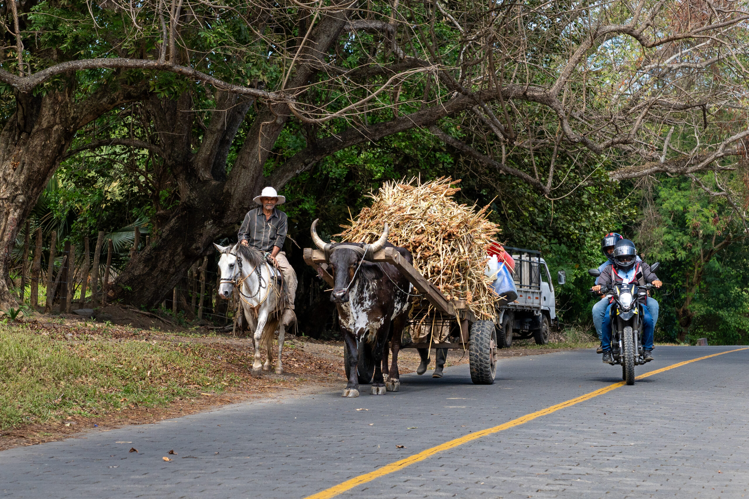
    Renting a car makes a lot of sense if you want freedom. The main roads between cities like Managua, León or Granada are in very good condition. The smaller roads are often in surprisingly good condition, often with a surface of interlocking paving stones instead of asphalt. This makes a car often the most efficient way to get to more remote places. However, in the mountains and really remote areas the surface can turn to dust or mud, especially after rain. Driving is otherwise fine, just expect a slower pace and occasional chaos.
  • Chicken bus & colectivo
    The cheapest and most authentic way to get around. Old American school buses go almost everywhere, but they are slow, crowded and without a fixed schedule. Colectivos, which are minivans, are a bit faster and more comfortable, but it’s still more about patience than comfort.
  • Boat
    There are some places you can’t get to except by water. Typically Ometepe Island with a ferry from San Jorge or more remote areas in the southeast. The cruise from San Carlos to El Castillo and on towards San Juan del Norte is one of the slower but more powerful experiences.
  • Hitchhiking
    Hitchhiking works surprisingly well, especially off the main routes. But communication is key, and you won’t be able to get by without basic Spanish. The locals are open and will often stop, but it all depends on your agreement and ability to communicate.

Nicaragua is not about one “must-see” place, but about a whole mosaic of experiences. Every corner of the country offers something different. From active volcanoes to colonial cities to forgotten buildings in the middle of the jungle. And in Nice, more than anywhere else, the most interesting moments come off the beaten track, somewhere in between.

Volcano Telica

One of the most active volcanoes in the country, where you can reach the very edge of the crater and literally hear it breathing. Spending the night at the top is an intense experience—wind, silence with a deep rumble as an undertone, and the feeling that you are very far from everything.

Matagalpa

Green mountains and coffee plantations give this region a completely different atmosphere from the rest of the country. It’s a place for slowing down—mist, rain, and long conversations over strong coffee.

Rio San Juan

A river that sets the pace for everything around it. Traveling between San Carlos and El Castillo feels like stepping back in time, where things happen slowly and without haste.

Volcano boarding

Riding down an active volcano on a board sounds like a crazy idea—and it absolutely is. Dust, speed, and laughter you can’t really control.

Canta Gallo

A mysterious place at the very edge of the map, where the road ends and another world begins. An area connected with the Rama community has a unique, hard-to-describe atmosphere that stays with you.

Leon

Rougher, more vibrant, and more “real” than the rest of Nicaragua. Colonial architecture, revolutionary history, and an energy that either grabs you—or not at all.

Granada

Colorful, calmer, and more polished than León. Ideal for a first introduction to the country—colonial houses, cafés, and a slower pace.

Ometepe

An island in the middle of a lake formed by two volcanoes. A place where it’s easy to lose yourself for a few days among the jungle, views, and the slow rhythm of life.

Indio Maiz

One of the wildest areas of Nicaragua, where the jungle truly begins to feel like jungle. Silence, humidity, and the sense that you’re a guest in something much bigger.

Jiquilillo

A forgotten beach in the north where not much happens—and that’s exactly its charm. Long, empty stretches of coastline, wind, and the feeling of being completely off the beaten path.

Accommodation, food and vibe

  • Accommodation..
    .. is simple, but mostly clean and functional. The backpackers scene is good here (mainly León, Granada, Ometepe, San Juan del Sur), but once you get off the main routes, the standard drops quickly – and that’s actually part of the experience. Outside of these areas, the offer is still surprisingly wide, you just have to look a little. In the jungle, the rules change completely and you often end up in a hammock with a mosquito net, which is more of an experience than a comfort.
  • The food
    is simple and filling. The classic is gallo pinto (rice with beans..breakfast, lunch, dinner..), fried plantains or chips made from them, fried cheese, and chicken or beef. No great gastronomy, but it works. The best food is found in small local “comedors” or markets. By the sea, around Lake Nicaragua and in the Rio San Juan area, fish is often found, which is among the best that the local cuisine has to offer.

And then there are three things that deserve their own chapter:

  • Rum
    Rum is everywhere in Nice and it’s good (although not as great as in Panama). The most famous and actually you can buy it almost everywhere is Flor de Caña. Rum is often drunk in the Coco Loco drink. This is a mixture of rum, coconut water and sometimes pulp, often served directly in a coconut (final ratio about 1:1). And what’s bizarre is that it’s common for rum to be sold in 1.5l PET bottles.
  • Nica coffee
    produces great coffee, especially in areas like Matagalpa or Jinotega. Really great, I personally have had a lot of fun with it 🙂
  • Cigars
    Nica is one of the largest producers of cigars in the world and the quality is really high. Areas like Estelí are famous for their production and if you are even slightly interested it is worth visiting a local factory or a small family production. Cigars here are significantly cheaper than in Europe and often much more authentic. Not a souvenir, but a real craft.
Volcano Telica, Nicaragua

¡Así que vámonos y nos vemos en Nicaragua!

Views: 136

March 24, 2026 0 comments
1 FacebookTwitterPinterestOdnoklassnikiRedditEmail

Categories

  • Africa (1)
    • Namibia (1)
  • America (2)
    • Nicaragua (2)
  • Nezařazené (1)
  • Facebook
  • Instagram
  • Linkedin
Live and Tavel
  • Afrika
  • Amerika
  • Asie
  • Evropa
  • Karibik
  • Oceánie
  • Rady a inspirace
  • Průvodce
  • Itineráře
  • Přednášky
  • Kontakt
  • Čeština
  • English